“Where to?”: plan a trip and let the app guide you, step by step
User guide · updated 19.10.2026
You choose where you're going; the app tells you which way to go, how long it takes and, once under way, the course to steer and the time remaining. This guide follows a real trip, from Rolle to Yvoire harbour, screen by screen.
What it's for
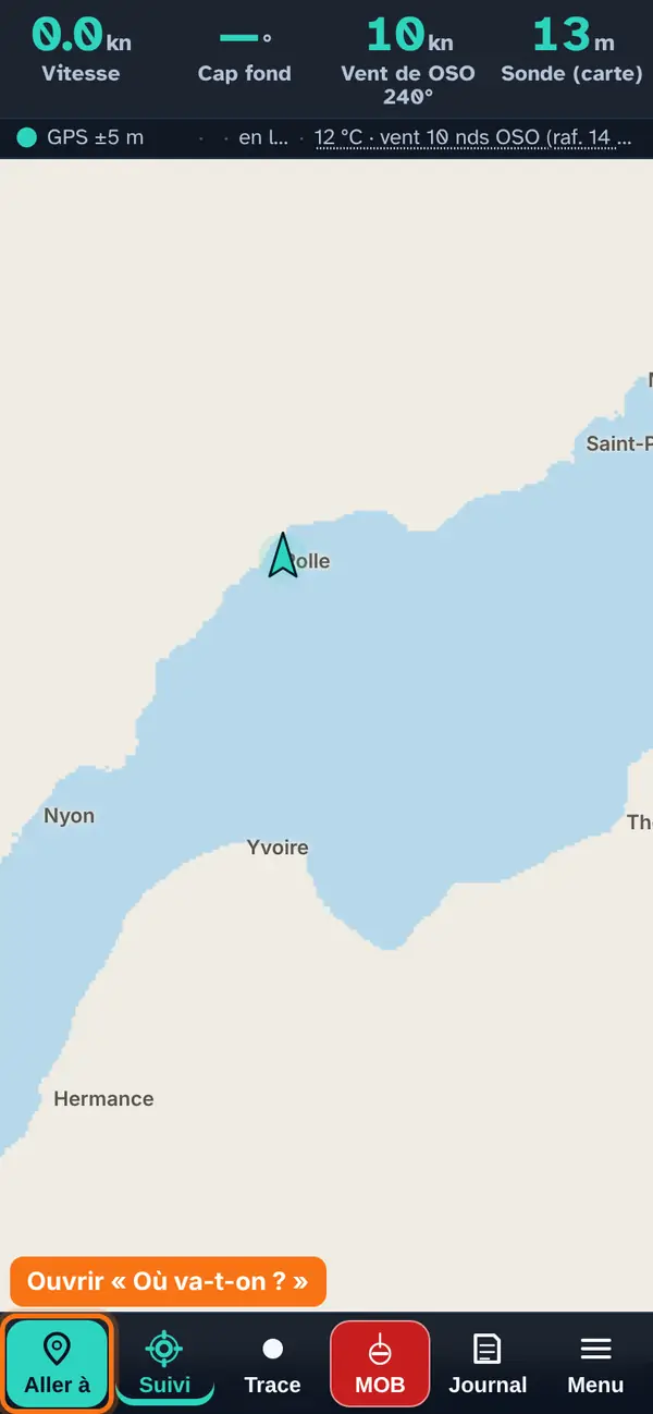
“Where to?” is for planning a trip and following it. Before you leave, it answers the questions you ask yourself on the pontoon: which way to go, how long it takes, what time you'll arrive, and whether sail beats engine with the forecast wind. Once under way, it gives the course to steer, the distance and time remaining, and keeps an eye on your route.
In three steps:
- Choose the destination — a name, or a tap on the map.
- Read the trip — course, distance, duration and the purple route.
- Tap “▶ Let's go” — the app guides you to the destination.
Opening the panel
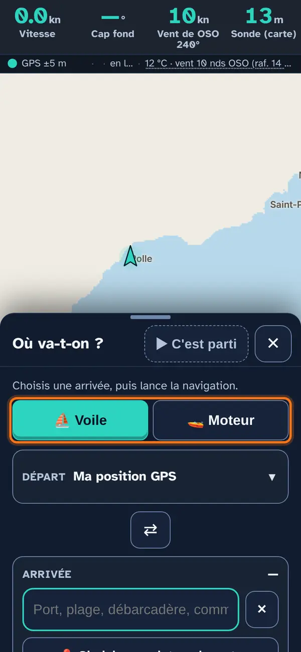
Tap Go to, at the bottom left of the screen. The panel opens on the lower half: the map stays visible and usable above it.
- Sail or engine, at the top of the panel: choose this first, because the whole route depends on it. ⛵ Sail: the route follows the forecast wind and your boat’s polar, with tacks and gybes when that is faster. 🚤 Engine: the shortest line that avoids the land, at your planned speed, ignoring the wind.
- Bigger, smaller: drag the title bar up (almost the whole screen) or down (only the bar remains, sitting above the buttons). A tap on the small handle switches from collapsed to half.
- Close: ✕. Dragged all the way down, the panel doesn't close: you won't lose it by mistake while under way.
- Start: this is your GPS position, unless you choose another one (see below). It stays collapsed to leave room for the destination.
Why a panel that leaves the map visible? So you can watch the route take shape while you adjust it, and keep an eye on your position.
Choose the destination
Four ways, depending on what you have in mind.
You know the name
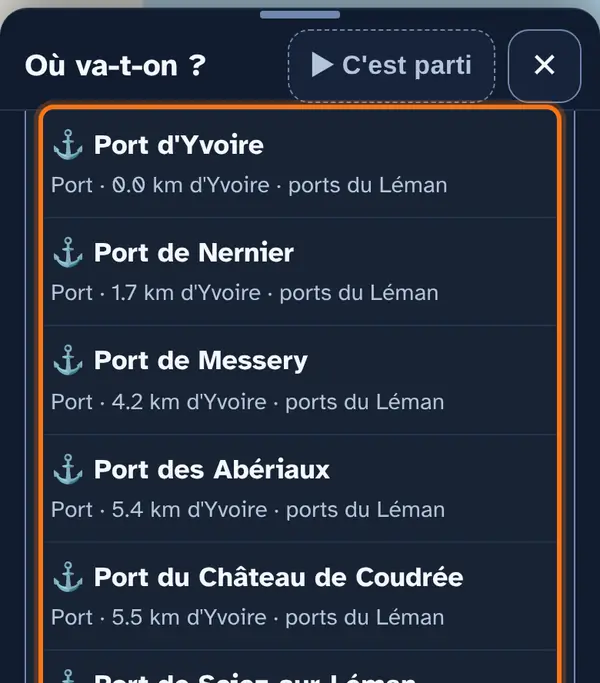
Type the name of a harbour, beach or landing stage in Destination, then tap the right line. Each suggestion says what it is (harbour, beach…) and how far it is from the place you typed.
Why only places on the lake? Because you arrive by boat: a street address in town would be no use as a destination.
You know the municipality
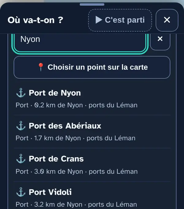
Just type “Nyon”, “Rolle”, “Évian”… The app suggests the harbours and beaches around the municipality, from nearest to furthest.
You're aiming for a spot on the map
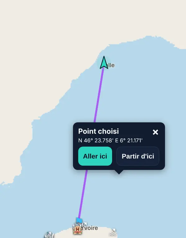
Tap the map where you want — a cove, an anchorage, a buoy. A pop-up opens with the point's coordinates: Go here makes it your destination, Start from here your start.
You want to be precise
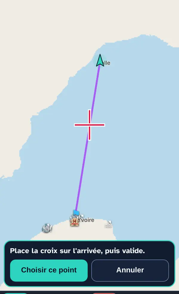
Under the destination field, 📍 Choose a point on the map puts a cross in the centre of the screen. Drag the map until the cross is on the right spot, then Choose this point.
Why the cross? With a finger on a small screen, you rarely hit the right metre; here you see exactly where the point lands before confirming.
Last way: from any place shown on the map (a harbour, a beach, a beach bar…), the place's pop-up has a Set course button.
A different start? Expand Start and choose it the same way (name, “📍 My position”, or a point on the map). The ⇄ button swaps start and destination: handy for planning the return trip.
Read the trip
The top bar
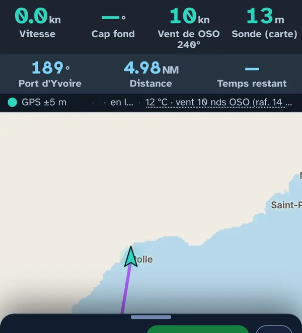
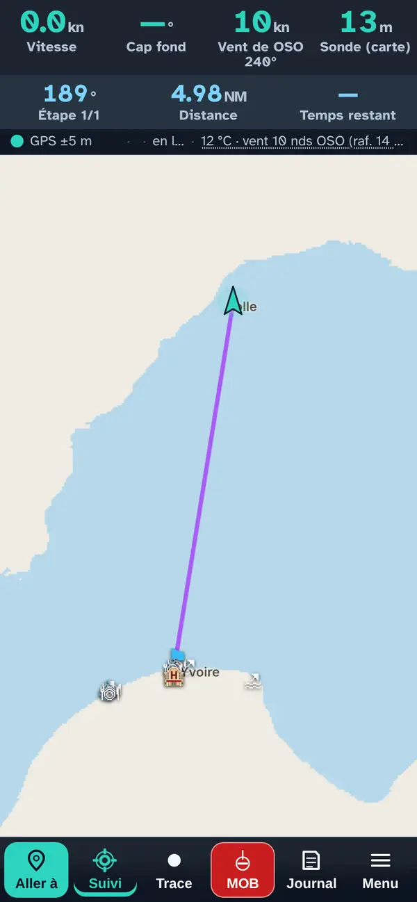
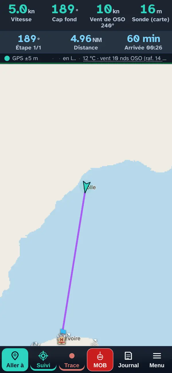
As soon as the destination is chosen, a second line appears below the instruments: the course to follow (here 189°), the distance (4,98 nautical miles) and the time remaining, which fills in as soon as the boat gets moving. The calculated route appears on the map straight away (see below).
The direct trip
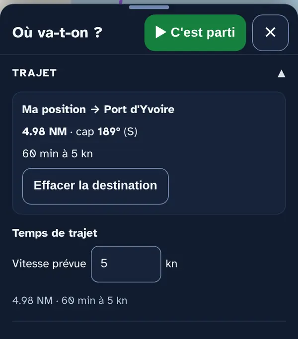
Expand Trip: distance, course and duration in a straight line, at the planned speed you set just below (5 knots by default).
Why two calculations? The direct trip is the quick estimate, useful under engine or to get an idea. The calculated route, below, takes the wind, the land and your boat into account.
The calculated route
The purple route
The app works out the fastest route on its own and draws it in purple. It goes around land, restricted areas and anything built on the water — jetties, breakwaters and pontoons — keeping a margin from the shore (200 m by default), and leaves or enters a harbour through its entrance. A small purple circle marks each change of course; tap it to read the new course.
Under sail, the route does not cross the Geneva harbour (inside the Pâquis and Jet d'eau jetties), which is prohibited to craft without an engine; if you start or finish in the harbour, it goes in and reminds you to do so under engine, at 10 km/h near the shore, without anchoring.
Here the route is straight: the wind comes in at 58° to the course, you sail on a close reach without tacking, and the straight line really is the fastest. With a headwind, the route tacks; downwind, it gybes if that's faster.
The route sheet
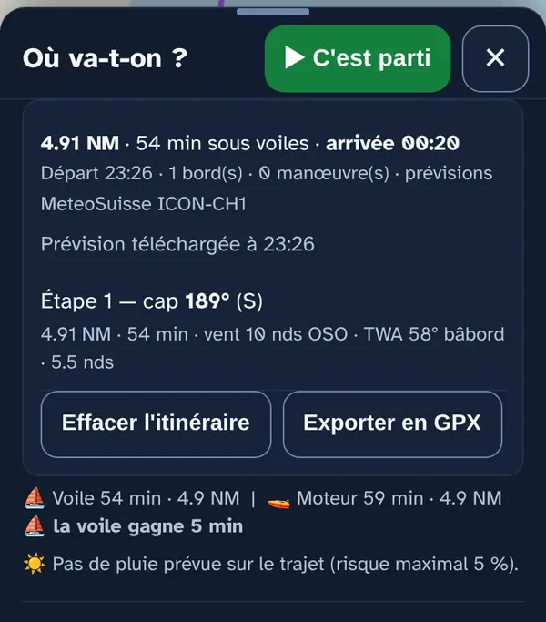
Expand Route. The sheet gives the time under sail, the arrival time, the number of tacks and manoeuvres, then each leg: course, distance, duration, wind, TWA (the angle between the wind and your course) and the speed taken from your boat's polar.
Below, the sail / engine comparison (“sail wins by … min”) and the risk of rain along the trip, at the times you'll be passing. Export as GPX sends the route to other software or a GPS.
Adjust the calculation
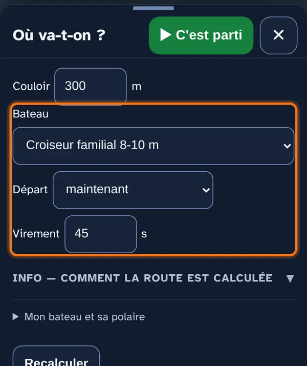
Boat, departure time, tack
- ⛵ Sail or 🚤 Engine: at the top of the panel (see above). Under sail, the route follows the forecast wind and your polar; under engine, it is the shortest line that avoids the land, at the planned speed.
- Boat: choose the model closest to yours — Lake Geneva boats (Surprise, Grand Surprise, Toucan…), cruisers, dinghies and sportsboats.
- Departure: now, in 1 to 6 hours, or at a set time.
- Tack: what a manoeuvre costs you, in seconds (45 by default). The higher it is, the fewer tacks the route makes.
- Shore margin, corridor and off-course alarm: further up in the same section.
Why the departure time? The wind changes during the day. For a departure at 14:00, the route uses the wind forecast for the time you will pass each point, not the current one.
After a change, tap Recalculate.
My boat and its polar
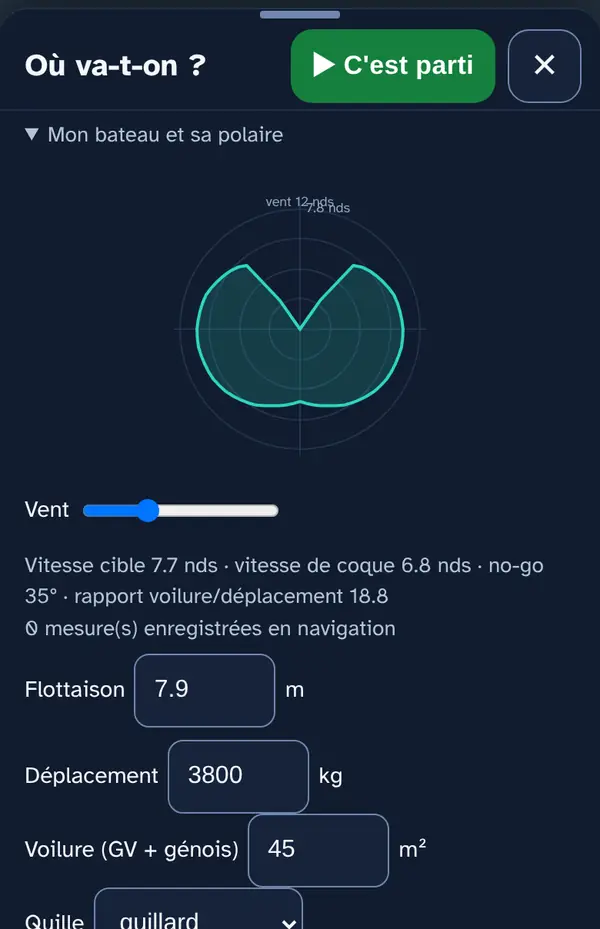
For an accurate route, describe your boat in My boat and its polar: waterline length, displacement, sail area, keel, rig. The app derives a polar from it: the boat's speed at every wind angle and wind strength. If you know a few real speeds (wind angle, wind strength, observed speed), enter them: they calibrate the model. Save and recalculate applies everything; Standard boat starts again from a standard boat.
Let's go
Start navigating
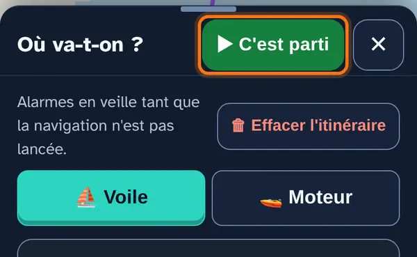
When everything is ready, tap ▶ Let's go at the top of the panel. The panel closes and the app:
- switches on the alarms: off-course, danger zone, wind warning, shallow water, thunderstorm;
- starts recording the track and keeps the screen on;
- logs the departure in the logbook;
- if you had planned a later departure, starts from the actual time and recalculates the route;
- shows the risk of rain along the way, and warns you if the bottom shoals near your route.
Why wait for “Let's go”? So you can prepare the outing calmly in the harbour, without an alarm going off because the boat is “off course” at its berth.
Under way
At the top of the screen: your speed and course over ground, and on the second line the leg course, the remaining distance and the arrival time. Keep your course over ground on the leg course. If you leave the corridor around the route (300 m each side by default), the off-course alarm sounds.
On arrival, reopen the panel and tap ■ Finish: the track stops and the logbook records the distance and duration.
If the wind changes: rerouting
Recalculating under way
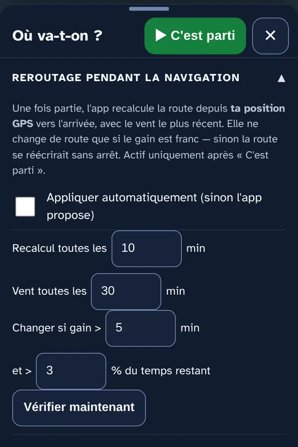
Once under way, the app recalculates the route from your position with the latest wind: every 10 minutes, reloading the forecast every 30 minutes. It only offers a new route if it saves more than 5 minutes and more than 3% of the remaining time. Tick Apply automatically to let it change route without asking you. Check now recalculates straight away.
Why a threshold? Without it, the route would change with every small shift in the forecast, and you would no longer know which course to hold.
At anchor and near the shore: the two alarms
Anchor alarm, depth and shallow water
Further down the panel, two sections that are not map layers but on-board alarms.
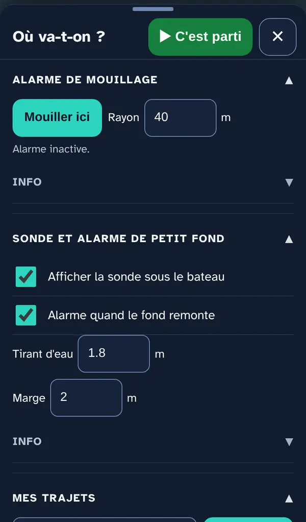
Anchor alarm: set the radius of the swinging circle (roughly the chain length), then tap Anchor here where the anchor is. The app stores the position and watches your drift: if the boat leaves the circle, it sounds and vibrates. Weigh anchor stops it when you leave.
Depth readout and shallow-water alarm: “Show depth under the boat” displays the modelled bottom under your position. Set your draught and a margin: the alarm sounds when the shallowest point within a 100 m radius becomes less than your draught plus the margin — and only once Let's go has been started.
Why here and not in a map menu? Because you set them when leaving or stopping, along with the rest of the outing. The bottom comes from swissBATHY3D on a 50 m grid, corrected for today's water level: it is not an echo sounder and sees neither isolated rocks nor wrecks.
Around the destination
Near the destination
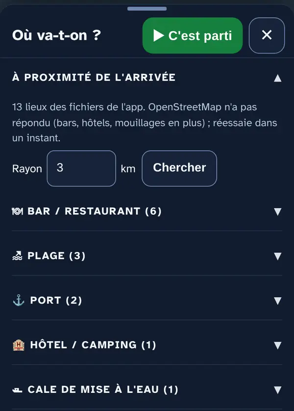
Open Near the destination: the app looks for harbours, anchorages, beaches, bars, restaurants and hotels within the chosen radius (3 km by default, up to 15) and places them on the map. Each type expands; each place has its pop-up, with Set course.
Keeping your trips
My trips and places
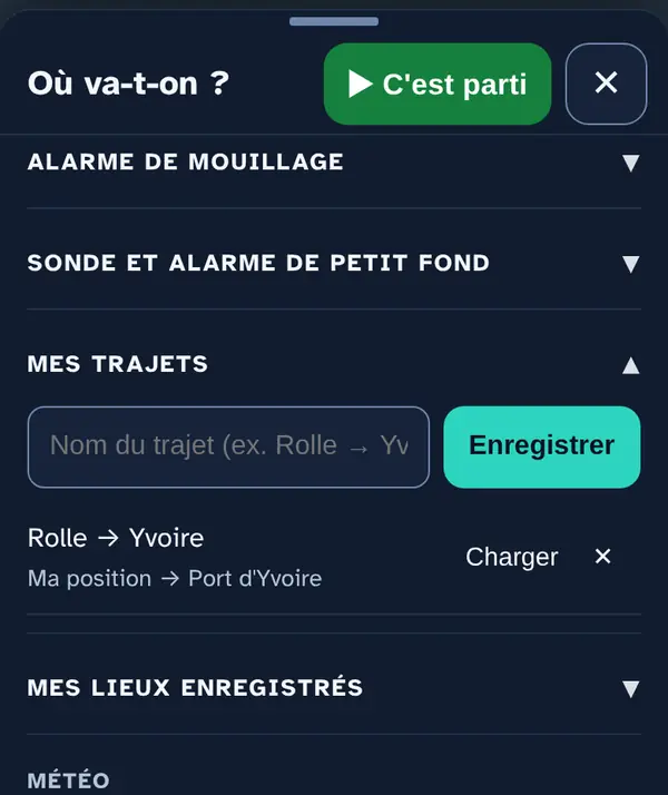
In My trips, enter a name (“Rolle → Yvoire”) and tap Save: start and destination are kept. Load puts start and destination back, and the route is recalculated with today's forecast; ✕ deletes the trip. My saved places keeps the places you saved from their pop-up.
🗑 Clear route, at the top of the panel, removes start, destination and route in one go.
Weather along the trip
Start and destination
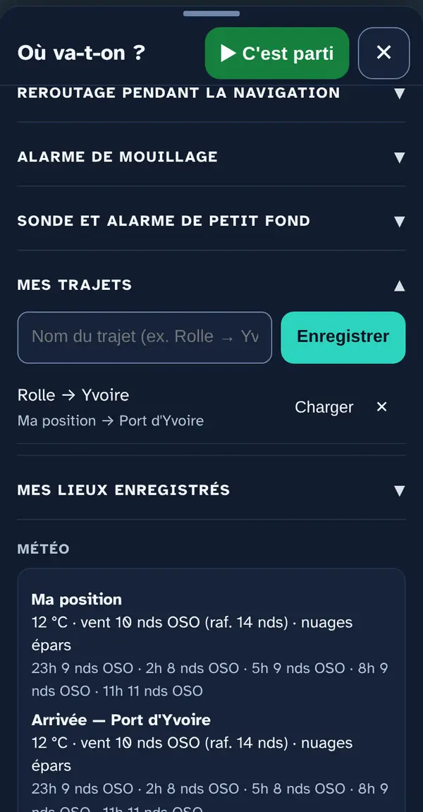
At the very bottom of the panel, the weather at the start and the destination: temperature, wind and gusts now, then the wind for the next few hours. For station readings and wind warnings, see the Wind and weather menu.
Frequently asked questions
The route is a straight line: is the wind taken into account?
Yes. The calculation looks for the shortest time, not the shortest distance. On a beam reach, the straight line is often the fastest. The leg pop-up shows it: it gives the wind angle (TWA) and the speed taken from your polar.
“Point moved onto the water”: what does that mean?
Your start or destination falls on land or in a basin too small for the lake map (a quay, a harbour). The calculation starts from the nearest point on the water; the point shown, however, does not move.
“No route found”
Try a destination a little further offshore, or a smaller shore margin: with a large margin, the entrance to a small harbour can end up “closed”.
What about the current?
On Lake Geneva it rarely exceeds 0,3 knot: it doesn't change the route, but it pushes you sideways. Each leg then gives the course to steer to stay on the line, the drift and the speed over ground, based on Eawag's 3D model at the departure time. If Eawag doesn't respond, this line doesn't appear: it is never made up.
No signal?
The sailing route needs the wind forecast: calculate it in the harbour, before you leave. Once under way, the route, the course to steer and the off-course alarm work with GPS alone; anything from the Internet (forecast, wind warnings, rain) updates when the network comes back.
What this menu tells you, and what it doesn't
What it tells you. An optimal route for your polar and the FORECAST wind, the course to steer with the modelled current, the estimated time.
What it doesn't tell you. The route sees neither gusts, nor a wind shift the model did not forecast, nor an obstacle missing from the data (boat at anchor, net, works buoy). Depths come from a 50 m model: keep a lookout and use the official chart.
Navleman is a navigation aid, not an official nautical document: the official chart, the storm warning lights and the authorities' instructions always take precedence.