⚓ NavlemanOpen the map

“Fish and fishing” menu: where to look for each species, and fishing addresses

User guide · updated 19.10.2026

One map per species, where the depth, water temperature and season suit it; then where to buy a permit, tackle or lake fish, and who to go out with.

What this menu is for
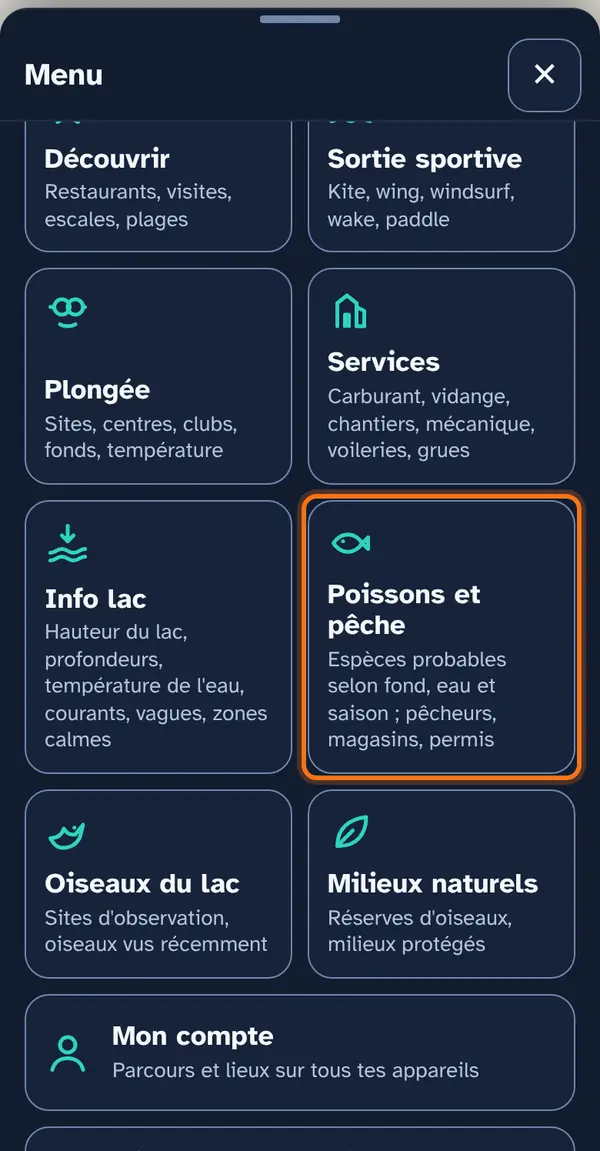
The Navleman menu, with the “Fish and fishing” tile circled.
Menu, then the “Fish and fishing” tile.

Each species is a map: where conditions suit it today — or up to four days ahead. A habitat map, not a fish finder: a green area promises no catch.

After the seven species, the four fishing maps: professional fishers, tackle shops, associations and guides, permit outlets.

How to use it

Open the menu

Tap Menu, bottom right, then the menu's tile. At the top: 📖 User guide for this menu (this page) and ↺ Reset maps, which switches everything off at once.
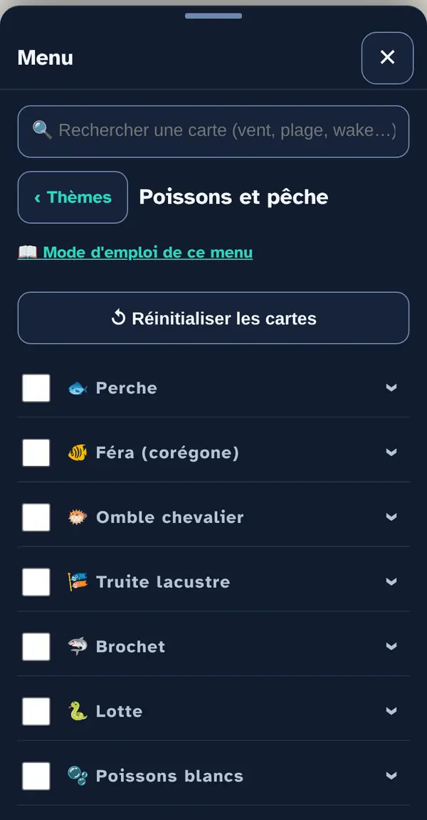
The open menu, with its list of map layers and a checkbox in front of each.
The open menu: one row per map layer.

Turn on a map layer

Tick a map layer's box to lay it over the base map; untick it to remove it. The arrow at the right of the row opens its info note: what the layer shows, its colour key, its source and what it doesn't tell you. An OFFLINE label marks a layer built into the app, which works without signal.

One species at a time: they are drawn on the same background and would hide one another. While shown, it replaces the sky maps. Below the list, the day slider (today, tomorrow… up to four days) and the day's favourable area for the chosen species.

Why checkboxes? So that only what's useful right now goes on the map: ten layers switched on together become unreadable.
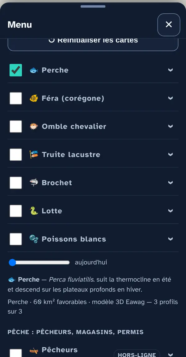
Two map layers ticked in the list; the arrow at the right of a row opens its info note.
Tick the box; the arrow on the right opens the layer's info note.

Reading the map

Perch in October off Rolle: the green band follows the shelf edge, where the bottom and water suit it. Solid colour: favourable; medium shade: possible; light shade: unlikely; grey hatching: restricted area, no indication given there.
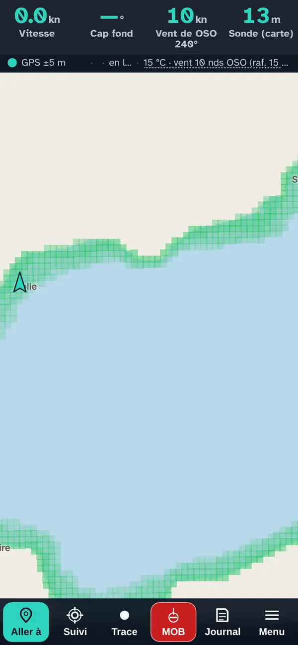
The lake off Rolle, a green band along the shore.
Perch: a favourable band along the shore.

Tap a point: the pop-up

  • The bottom: mean depth of the cell, and the highest point within 50 m.
  • The water: the temperature at the surface and at the bottom, and the bottom slope.
  • The profile: the temperature curve from surface to bottom, from Eawag — it shows the thermocline, the layer where the water changes abruptly from warm to cold.
  • The plausible species at this point, from “favourable” to “possible”.
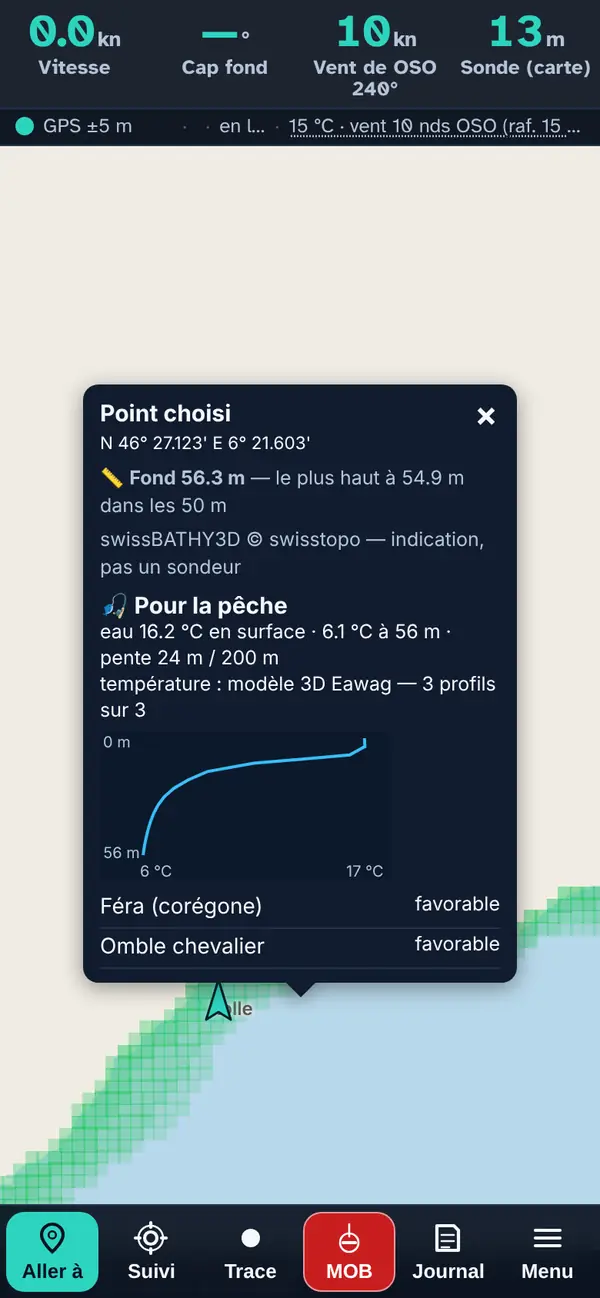
The “Selected point” pop-up off Rolle: depth 56,3 m, water 16,2 °C at the surface and 6,1 °C at the bottom, slope, the plotted temperature profile, then the plausible species at this point.
Tap the map: depth, temperature from bottom to surface, and the plausible species.

Fishing places

Below the species and the day slider, four place layers: professional fishers, fishing tackle shops, fishing associations and guides, fishing permits — where to buy. They are simple places: they switch on alongside a species without switching it off, and neither the “one species at a time” rule nor the day slider affects them.
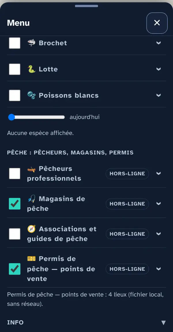
The end of the Fish and fishing list: below the species and the day slider, the heading “Fishing: fishers, shops, permits” and its four layers, two ticked.
Below the species: the four fishing layers.

Reading the places map

Tackle shops and Vaud permit outlets around the lake: each layer has its own icon.
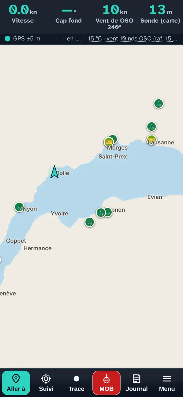
The Lake Geneva map with the icons of tackle shops and permit outlets.
Tackle shops and permit outlets.

Tapping a place: the pop-up

  • The name, preceded by the layer's icon.
  • Facilities — harbour name (expandable): when the place bears a harbour's name, that harbour's facilities confirmed by an official source (slipway, crane, pump-out, fuel) and the harbour master's office phone number.
  • The practical note when known: access from the beach or the nearby harbour, season, booking.
  • A row of links: the website ↗, the phone number (one tap calls) and “View on Google Maps ↗”.
  • Sources and position (expandable): where the place comes from and how its position was obtained — official address, OpenStreetMap or read off the map.
  • Set course makes it your destination in “Where to?”; Start from here, your starting point.

Professional fishers sell according to the day's catch: call before you go.
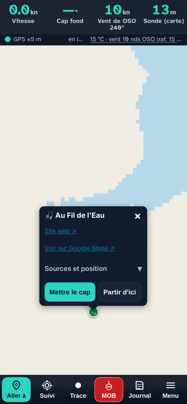
A tackle shop's pop-up: website, Google Maps, sources and position, Set course, Start from here.
A tackle shop's pop-up.

How the data is cross-checked

For each 200 m grid cell of the lake, the app matches three things against the species' preferences:

  1. Depth (swissBATHY3D, swisstopo): each species has a range per season.
  2. The water temperature at that depth: the profile from Eawag's 3D model for the lake sector (Petit Lac, Grand Lac, Haut Lac), at the chosen hour. If Eawag does not respond, the app falls back on the measured surface temperature, and failing that on depth and season alone — it says so in the note.
  3. Season: a bonus when it is the right time of year for the species (spawning, fishing season).

The weighting: half for temperature, three tenths for depth, two tenths for season; then a bonus for breaks of slope, and for edges or drop-offs depending on the species. Restricted areas are never coloured.

Fishing places are not calculated: shops, clubs and outlets come from the app's verified files; permit outlets from the list of approved resellers of the canton of Vaud; professional fishers from the list of the French-speaking Swiss professional fishers' association.

The map layers in this menu

For each species: where the app looks for it by season, the water that suits it, and what the model favours. These are the settings of the app's model, drawn from each species' known preferences. Then come the four fishing-place layers.

🐟 Perch

Perca fluviatilis. Follows the thermocline in summer and moves down onto the deep shelves in winter.

SeasonDepth where the app looks for it
Spring (March to May)2 to 12 m
Summer (June to August)3 to 15 m
Autumn (September to November)8 to 30 m
Winter (December to February)30 to 70 m

Preferred water: 12 to 22 °C at that depth, from the Eawag profile. The model also favours edges shallower than 12 m (edge bonus). Most favourable season in the model: summer and autumn.

favourablepossibleunlikelyrestricted area

Source: depths swissBATHY3D © swisstopo · temperature from the Eawag 3D model

🐠 Whitefish (féra)

Coregonus sp. An open-water fish, it keeps to cold water in mid-water; moves closer to its spawning grounds in late autumn.

SeasonDepth where the app looks for it
Spring (March to May)15 to 45 m
Summer (June to August)20 to 60 m
Autumn (September to November)25 to 70 m
Winter (December to February)30 to 80 m

Preferred water: 4 to 12 °C at that depth, from the Eawag profile. Most favourable season in the model: autumn and winter, between 30 and 90 m (approaching the spawning grounds).

favourablepossibleunlikelyrestricted area

Source: depths swissBATHY3D © swisstopo · temperature from the Eawag 3D model

🐡 Arctic char

Salvelinus umbla. The most cold-loving of our species; great depths, rises a little in the cold season.

SeasonDepth where the app looks for it
Spring (March to May)30 to 90 m
Summer (June to August)45 to 120 m
Autumn (September to November)30 to 90 m
Winter (December to February)20 to 70 m

Preferred water: 3 to 9 °C at that depth, from the Eawag profile.

favourablepossibleunlikelyrestricted area

Source: depths swissBATHY3D © swisstopo · temperature from the Eawag 3D model

🎏 Lake trout

Salmo trutta lacustris. Hunts along drop-offs and edges, often in shallow water when the water is cool.

SeasonDepth where the app looks for it
Spring (March to May)3 to 25 m
Summer (June to August)10 to 40 m
Autumn (September to November)3 to 25 m
Winter (December to February)2 to 20 m

Preferred water: 6 to 14 °C at that depth, from the Eawag profile. The model also favours drop-offs (slope bonus). Most favourable season in the model: spring and autumn.

favourablepossibleunlikelyrestricted area

Source: depths swissBATHY3D © swisstopo · temperature from the Eawag 3D model

🦈 Pike

Esox lucius. Hunts by ambush in aquatic plant beds and on shelves; in spring it spawns right by the shore.

SeasonDepth where the app looks for it
Spring (March to May)0,5 to 5 m
Summer (June to August)1 to 8 m
Autumn (September to November)1 to 10 m
Winter (December to February)2 to 12 m

Preferred water: 10 to 19 °C at that depth, from the Eawag profile. The model also favours edges shallower than 12 m (edge bonus). Most favourable season in the model: spring, in less than 6 m (spawning near the shore).

favourablepossibleunlikelyrestricted area

Source: depths swissBATHY3D © swisstopo · temperature from the Eawag 3D model

🐍 Burbot

Lota lota. A bottom-dwelling, cold-water fish; it comes up in winter, which is when it is caught.

SeasonDepth where the app looks for it
Spring (March to May)30 to 120 m
Summer (June to August)50 to 200 m
Autumn (September to November)30 to 120 m
Winter (December to February)5 to 60 m

Preferred water: 2 to 10 °C at that depth, from the Eawag profile. Most favourable season in the model: winter.

favourablepossibleunlikelyrestricted area

Source: depths swissBATHY3D © swisstopo · temperature from the Eawag 3D model

🫧 Coarse fish

roach, bream, tench, carp…. Grouped together: roach, rudd, bream, tench, carp, chub, bleak, dace, barbel — same shallow, mild waters.

SeasonDepth where the app looks for it
Spring (March to May)0,5 to 6 m
Summer (June to August)1 to 8 m
Autumn (September to November)2 to 12 m
Winter (December to February)4 to 20 m

Preferred water: 12 to 24 °C at that depth, from the Eawag profile. The model also favours edges shallower than 12 m (edge bonus). Most favourable season in the model: spring and summer.

favourablepossibleunlikelyrestricted area

Source: depths swissBATHY3D © swisstopo · temperature from the Eawag 3D model

🛶 Professional fishers works offline

The lake's professional fishers and where they sell their fish.

34 places on the map (8 Geneva, 13 La Côte, 3 Lausanne and Lavaux, 4 Riviera and Valais Chablais, 6 French shore), 34 with a website, 27 with a phone number.

Good to know. The published address is often a home or a hut, and sales depend on the day's catch: call before you go.

Source: Official source for each place (its website, the municipality, the tourist office, the canton), rechecked in October 2026 and named in the pop-up; position taken from the official address (geo.admin.ch, IGN); distance to the water calculated on swissBATHY3D · October 2026

🎣 Fishing tackle shops works offline

Fishing tackle shops.

12 places on the map (2 Geneva, 3 La Côte, 4 Lausanne and Lavaux, 3 French shore), 12 with a website, 10 with a phone number.

Good to know. The market is thin: Geneva and Thonon have practically just one shop each.

Source: Official source for each place (its website, the municipality, the tourist office, the canton), rechecked in October 2026 and named in the pop-up; position taken from the official address (geo.admin.ch, IGN); distance to the water calculated on swissBATHY3D · October 2026

🧭 Fishing associations and guides works offline

Angling clubs and the guides who take you fishing.

3 places on the map (1 Lausanne and Lavaux, 2 French shore), 3 with a website, 3 with a phone number.

Good to know. Prices and trip dates are not given.

Source: Official source for each place (its website, the municipality, the tourist office, the canton), rechecked in October 2026 and named in the pop-up; position taken from the official address (geo.admin.ch, IGN); distance to the water calculated on swissBATHY3D · October 2026

🎫 Fishing permits — where to buy works offline

Where to buy daily and weekly fishing permits (Vaud): shops, tourist offices, kiosks.

4 places on the map (1 La Côte, 1 Lausanne and Lavaux, 2 Riviera and Valais Chablais), 4 with a website, 4 with a phone number.

Good to know. Only resellers still on the 2025 list are kept. Geneva and France sell their permits mainly online.

Source: Canton of Vaud, official list of fishing permit resellers, version of 01.01.2025 · October 2026

What you need to know about these maps

A permit is mandatory. Fishing in Lake Geneva falls under a Franco-Swiss agreement implemented by Vaud, Geneva, Valais and France: closed seasons, minimum sizes, hours and permitted gear differ by shore and change from year to year. See Fishing in Lake Geneva.

The actual presence of fish also depends on food, light, turbidity, cold-water upwellings caused by the bise and the time of day: none of this is modelled.

A habitat model, not a detected fish: it shows where the conditions are right, not whether the species is there. Permits, sizes and closed seasons are governed by cantonal regulations.

What this menu tells you, and what it doesn't

What it tells you. Where habitat conditions are right; who sells what and where, from the official lists and the places' own websites.

What it doesn't tell you. It is not a fish finder: food, light, turbidity, cold-water upwellings and time of day are not modelled. No regulatory value: check permits, seasons, sizes and gear with the canton or the département.

Navleman is a navigation aid, not an official nautical document: the official chart, the storm warning lights and the authorities' instructions always take precedence.

Open the Lake Geneva map