“Sports outing” menu: where to go depending on sport and wind
User guide · updated 19.10.2026
Kite, wing, windsurf, wake, paddle, jet ski: the right water at the right time, and where to hire or learn.
What this menu is for
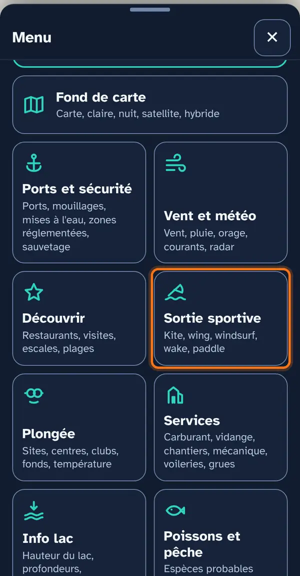
Two sections: maps by sport, calculated from the forecast wind and the shape of the lake, and rental spots — schools, clubs, hire companies and shops.
How to use it
Open the menu
Tap Menu, bottom right, then the menu's tile. At the top: 📖 User guide for this menu (this page) and ↺ Reset maps, which switches everything off at once.
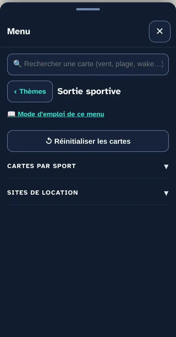
Turn on a map layer
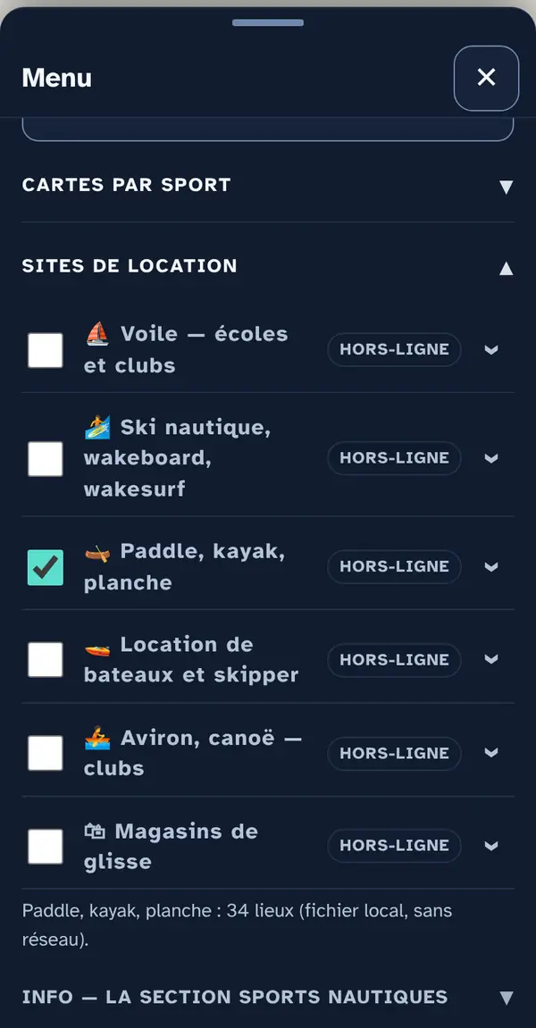
Tick a map layer's box to lay it over the base map; untick it to remove it. The arrow at the right of the row opens its info note: what the layer shows, its colour key, its source and what it doesn't tell you. An OFFLINE label marks a layer built into the app, which works without signal.
One map per sport at a time: “Kite and sailing — windy areas” for wind, “Wakeboard — flat water” or “Shelter” for calm water (wake, paddle, water-skiing). Then drag the time slider: you can watch the morning’s flat water close up by midday.
Why checkboxes? So that only what's useful right now goes on the map: ten layers switched on together become unreadable.
Reading the map
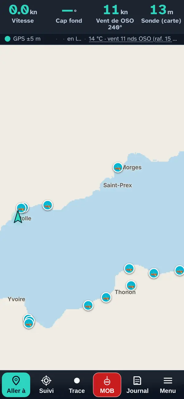
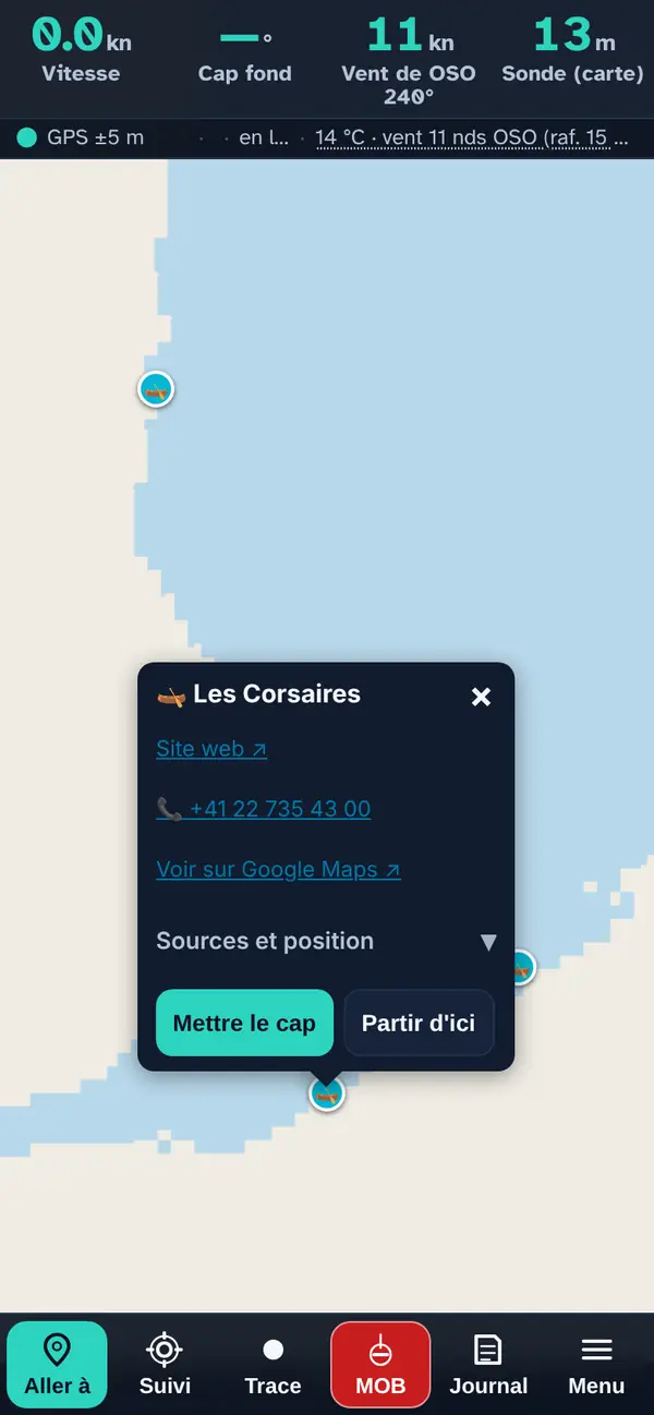
Rental spots are shown as points: here the paddle, kayak and board schools and hire companies around the Grand-Lac.
Tap a point: the pop-up
- The name, preceded by the layer's icon.
- Facilities — harbour name (expandable): when the place bears a harbour's name, that harbour's facilities confirmed by an official source (slipway, crane, pump-out, fuel) and the harbour master's office phone number.
- The practical note when known: access from the beach or the nearby harbour, season, booking.
- A row of links: the website ↗, the phone number (one tap calls) and “View on Google Maps ↗”.
- Sources and position (expandable): where the place comes from and how its position was obtained — official address, OpenStreetMap or read off the map.
- Set course makes it your destination in “Where to?”; Start from here, your starting point.
How the data is cross-checked
The maps by sport use the same calculation as the waves: for each 50 m grid cell, the forecast wind (ICON-CH1) and the fetch, the stretch of open water the wind travels over before reaching the point.
- Wakeboard — flat water: the estimated wave height; green below 10 cm.
- Kite and sailing: the wind AND the water ahead — “ideal” at 18 knots or more with over 3 km of open water, “good” at 12 knots or more with over 1,5 km, “light” from 8 to 12 knots.
- Shelter: fetch alone — well sheltered below 600 m, sheltered up to 2 km.
The rental spots come from the app's verified files, place by place.
Maps by sport
A synthesis built on what the app already knows: the forecast wind (ICON-CH1), the surface current (Eawag's 3D model) and the shape of the lake. Five readings of the same map — flat water for jet skis, windy areas for kite and sailing, a synthesis for navigation, wave height alone, and shelter for the current wind. You switch on one at a time, as with the fish species.
Each follows the time slider, which appears as soon as one of these layers is on: slide it and the map recalculates hour by hour, without waiting for you to let go. You can watch the morning's flat water close up by midday, and the shelter switch shores when the bise gives way to the joran.
Fetch is the key: the stretch of open water the wind travels over before reaching the point. The app calculates it by tracing back upwind from cell to cell until it hits land. A point 200 m to leeward of a shore is sheltered; the same point with 20 km of lake ahead of it gets a short, uncomfortable chop.
Wave height is an estimate, not a measurement. It uses the Sverdrup-Munk-Bretschneider formula, the one found in coastal engineering manuals for waves raised by the local wind. It knows nothing of residual swell, gusts or the cross chop after a wind shift. The only real wave measurement on Lake Geneva is the LéXPLORE buoy, off Pully, but Eawag only publishes its readings as weekly files, weeks late. So the app doesn't use it, and never displays a height presented as measured.
The drift alert sounds when the current under the boat exceeds 30 cm/s. Like the other alarms, it stays silent before “Let's go”.
🚤 Wakeboard — flat water
Flat-water areas at the time shown: little wind and above all little fetch, so no chop has built up. The time slider drives this layer: drag it and everything is recalculated.
Tip. Look for green: flat water, waves under 10 cm.
Source: Local calculation: Open-Meteo wind (ICON-CH1), swissBATHY3D shoreline and depths, current from the Eawag model. The fetch is calculated cell by cell in the app.
🪁 Kite and sailing — windy areas
Windy, open areas where the wind arrives without being blocked by the shore. The time slider drives this layer: slide it and everything recalculates.
Tip. Areas where the wind arrives without being blocked by the shore; check the actual wind at the nearest station.
Source: Local calculation: Open-Meteo wind (ICON-CH1), swissBATHY3D shoreline and depths, current from the Eawag model. The fetch is calculated cell by cell in the app.
🌊 Waves — estimated height
Wave height estimated from the wind and the fetch. The time slider drives this layer: drag it and everything is recalculated.
Tip. Drag the time slider to the time you'll be heading back: that's often when the chop builds.
Source: Local calculation: Open-Meteo wind (ICON-CH1), swissBATHY3D shoreline and depths, current from the Eawag model. The fetch is calculated cell by cell in the app.
🛡 Shelter — for this wind
Shelter from the wind shown: the areas the shore protects from the prevailing wind at that hour. The time slider drives this layer: drag it and everything is recalculated.
Tip. Shelter changes with the wind: check it for the time you'll arrive, not the time you set off.
Source: Local calculation: Open-Meteo wind (ICON-CH1), swissBATHY3D shoreline and depths, current from the Eawag model. The fetch is calculated cell by cell in the app.
Rental spots
Sailing, wake, waterski and rowing schools and clubs; paddleboard, kayak and boat hire; watersports shops. Each place was checked in October 2026 against an official source; those that no source confirms have been removed.
Many places are seasonal, and a club may be members-only: the pop-up doesn't say whether it welcomes visitors.
⛵ Sailing — schools and clubs works offline
Sailing schools and clubs.
41 places on the map (9 Geneva, 10 La Côte, 11 Lausanne and Lavaux, 6 Riviera and Valais Chablais, 5 French shore), 41 with a website, 33 with a phone number.
Good to know. A club may be members-only: the pop-up doesn't say whether it welcomes visitors.
Source: Official source for each place (its website, the municipality, the tourist office, the canton), rechecked in October 2026 and named in the pop-up; position taken from the official address (geo.admin.ch, IGN); distance to the water calculated on swissBATHY3D · October 2026
🏄 Waterskiing, wakeboarding, wakesurfing works offline
Waterskiing, wakeboard and wakesurf schools and clubs.
23 places on the map (9 Geneva, 2 La Côte, 6 Lausanne and Lavaux, 3 Riviera and Valais Chablais, 3 French shore), 23 with a website, 21 with a phone number.
Good to know. Several schools sometimes share the same harbour address.
Source: Official source for each place (its website, the municipality, the tourist office, the canton), rechecked in October 2026 and named in the pop-up; position taken from the official address (geo.admin.ch, IGN); distance to the water calculated on swissBATHY3D · October 2026
🛶 Paddleboard, kayak, board works offline
Paddle, kayak and board hire and lessons.
34 places on the map (7 Geneva, 6 La Côte, 4 Lausanne and Lavaux, 4 Riviera and Valais Chablais, 13 French shore), 34 with a website, 25 with a phone number.
Good to know. Many are seasonal: check they're open outside summer.
Source: Official source for each place (its website, the municipality, the tourist office, the canton), rechecked in October 2026 and named in the pop-up; position taken from the official address (geo.admin.ch, IGN); distance to the water calculated on swissBATHY3D · October 2026
🚤 Boat hire and skippers works offline
Boat hire, with or without a licence, and skippered trips.
15 places on the map (3 Geneva, 1 La Côte, 4 Lausanne and Lavaux, 2 Riviera and Valais Chablais, 5 French shore), 15 with a website, 10 with a phone number.
Good to know. The licence required and the rates are not given.
Source: Official source for each place (its website, the municipality, the tourist office, the canton), rechecked in October 2026 and named in the pop-up; position taken from the official address (geo.admin.ch, IGN); distance to the water calculated on swissBATHY3D · October 2026
🚣 Rowing, canoeing — clubs works offline
Rowing, canoe and kayak clubs.
7 places on the map (1 Geneva, 3 Lausanne and Lavaux, 1 Riviera and Valais Chablais, 2 French shore), 7 with a website, 1 with a phone number.
Good to know. Clubs are often members-only: the pop-up doesn't say whether they welcome visitors.
Source: Official source for each place (its website, the municipality, the tourist office, the canton), rechecked in October 2026 and named in the pop-up; position taken from the official address (geo.admin.ch, IGN); distance to the water calculated on swissBATHY3D · October 2026
🛍 Watersports shops works offline
Specialist watersports shops: windsurf, kite, foil, paddle, kayak.
8 places on the map (1 Geneva, 1 La Côte, 4 Lausanne and Lavaux, 1 Riviera and Valais Chablais, 1 French shore), 8 with a website, 6 with a phone number.
Good to know. General sports shops are not included.
Source: Official source for each place (its website, the municipality, the tourist office, the canton), rechecked in October 2026 and named in the pop-up; position taken from the official address (geo.admin.ch, IGN); distance to the water calculated on swissBATHY3D · October 2026
What you need to know about these maps
Wave height is an ESTIMATE using the Sverdrup-Munk-Bretschneider formula, never a measurement: it ignores residual swell, gusts and cross-chop after a wind shift.
What this menu tells you, and what it doesn't
What it tells you. An hour-by-hour estimate of wind, chop and shelter; places checked against an official source.
What it doesn't tell you. Wave height is calculated, never measured: no residual swell, gusts or cross chop. A club may be members-only, and many places are seasonal.
Navleman is a navigation aid, not an official nautical document: the official chart, the storm warning lights and the authorities' instructions always take precedence.