“Services” menu: fuel, pump-out, boatyards, mechanics, sail lofts, cranes
User guide · updated 19.10.2026
Refuel, pump out waste water, repair, maintain, equip or lift the boat out of the water.
What this menu is for
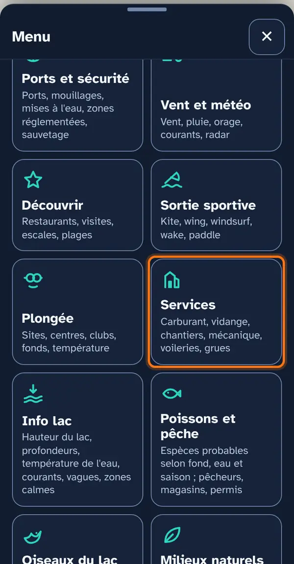
Two submenus. First At the harbour: fuel (verified quayside pumps, and OpenStreetMap), waste-water pump-out, harbour services (verified, and OpenStreetMap), waterside toilets and harbour cranes. Then Boatyards & services: boat professionals around the lake, each checked on their own website or their municipality's, plus boatyards and chandlers from OpenStreetMap.
Slipways and launching ramps stay under Harbours and safety.
How to use it
Open the menu
Tap Menu, bottom right, then the menu's tile. At the top: 📖 User guide for this menu (this page) and ↺ Reset maps, which switches everything off at once.
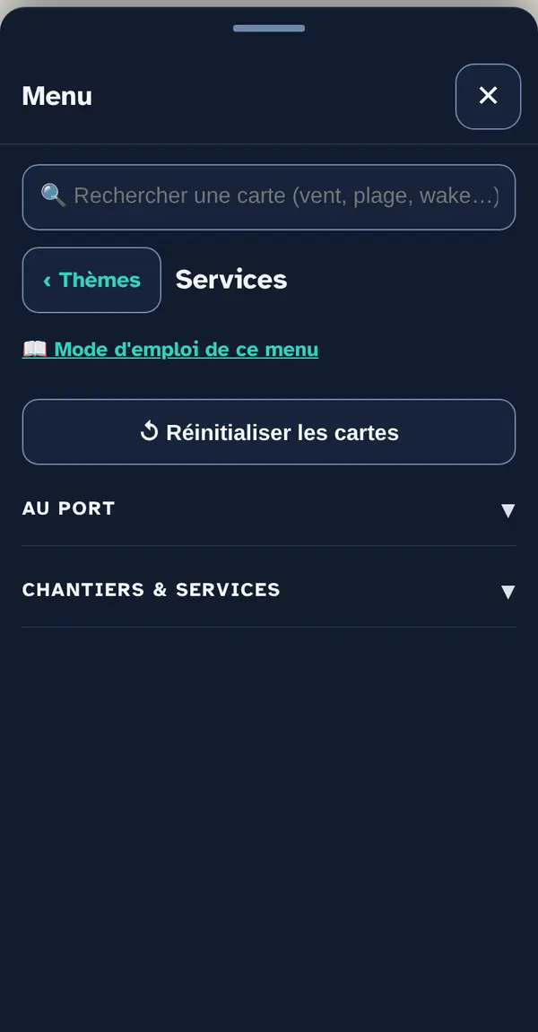
Two sections expand: At the harbour, then Boatyards & services.
Turn on a map layer
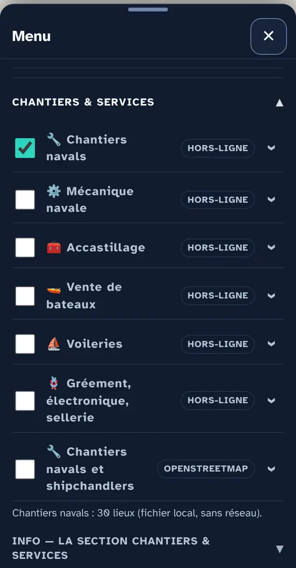
Tick a map layer's box to lay it over the base map; untick it to remove it. The arrow at the right of the row opens its info note: what the layer shows, its colour key, its source and what it doesn't tell you. An OFFLINE label marks a layer built into the app, which works without signal.
Two fuel layers: “Boat fuel” (confirmed quayside pumps, offline) for refuelling, “Marine fuel” (OpenStreetMap, mixing road filling stations and harbour pumps) so you miss nothing.
Why checkboxes? So that only what's useful right now goes on the map: ten layers switched on together become unreadable.
Reading the map
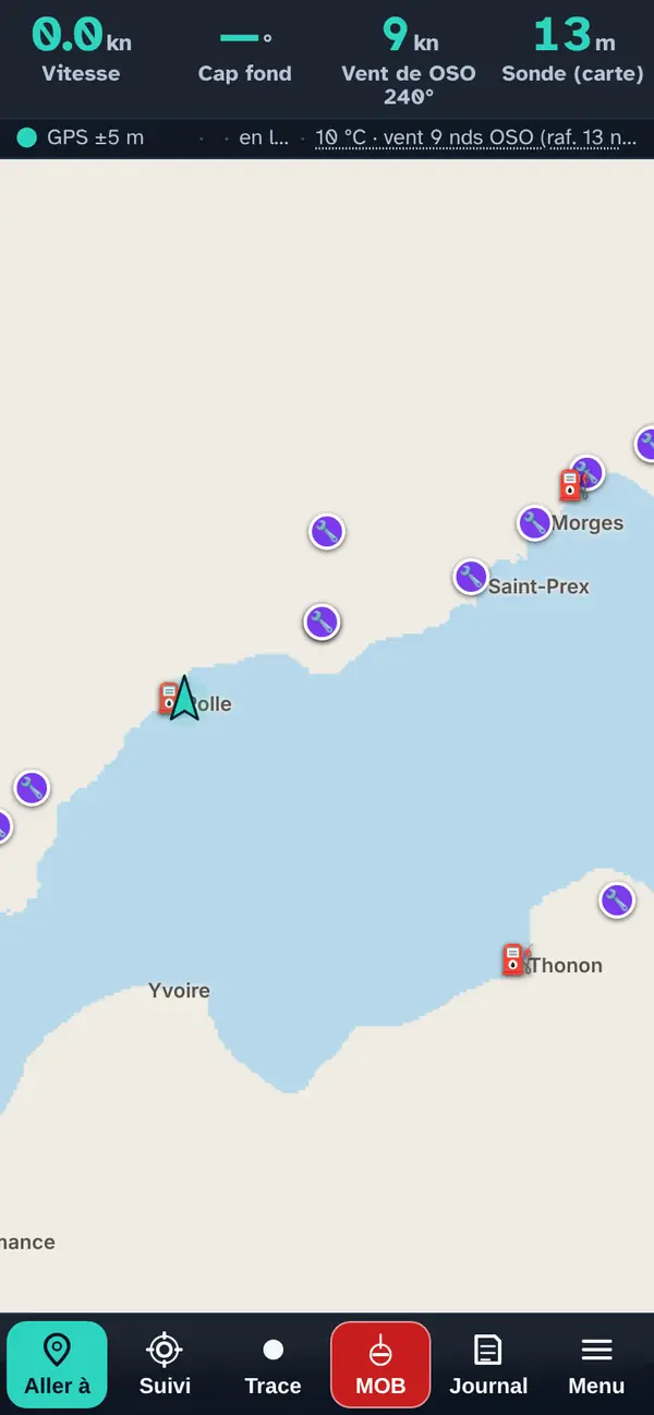
Boatyards and quayside fuel pumps between Geneva and Lausanne: turn on only what you need.
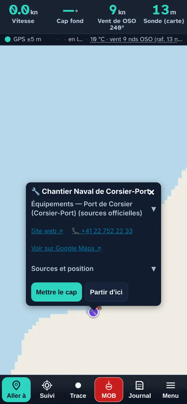
Tap a point: the pop-up
- The name, preceded by the layer's icon.
- Facilities — harbour name (expandable): when the place bears a harbour's name, that harbour's facilities confirmed by an official source (slipway, crane, pump-out, fuel) and the harbour master's office phone number.
- The practical note when known: access from the beach or the nearby harbour, season, booking.
- A row of links: the website ↗, the phone number (one tap calls) and “View on Google Maps ↗”.
- Sources and position (expandable): where the place comes from and how its position was obtained — official address, OpenStreetMap or read off the map.
- Set course makes it your destination in “Where to?”; Start from here, your starting point.
How the data is cross-checked
Each business was checked one by one on its own website or its municipality's, then placed at its official address where there is one. Nothing is taken from Google Maps.
At the harbour: “Boat fuel”, “Waste-water pump-out” and “Harbour services” come from the app's verified files, place by place, against an official source; “Marine fuel”, “Harbour services (water, WC, black water)”, the toilets and “Boatyards and ship chandlers” come from OpenStreetMap, kept separate (ODbL licence).
At the harbour
Refuel, pump out waste water, find water, toilets or a crane. Two kinds of source, kept separate: the layers verified harbour by harbour against an official source (Boat fuel, Waste-water pump-out, Harbour services, Harbour cranes), which work offline, and those taken from OpenStreetMap (Marine fuel, Harbour services — water, WC, black water —, Waterside toilets), more complete but unverified. Use the first to decide, the second so you miss nothing.
Sources and rights. Official pages of the harbours and operators, checked in October 2026. Everything marked OpenStreetMap comes from OSM contributors and remains under the ODbL licence, including the offline files extracted from it. Opening hours, prices and lifting capacity are not given: call the harbour before you come.
⛽ Boat fuel works offline
The lake's quayside pumps whose existence is confirmed by an official source (municipality, harbour master's office, operator), with the fuel sold.
Tip. The right layer for refuelling: only confirmed quayside pumps.
Good to know. A pump may be out of order, seasonal (Corsier-Port: mid-May to end of September) or card-only: call the harbour master's office before relying on it.
Source: Official pages of the harbours and operators, checked one by one in October 2026; official harbour position, otherwise OpenStreetMap harbour (ODbL) · October 2026
⛽ Marine fuel
Fuel points tagged in OpenStreetMap around the lake. Built-in file: works offline.
Good to know. OpenStreetMap mixes road filling stations and quayside pumps. For genuine harbour pumps, the “Boat fuel” layer is more reliable.
Source: OpenStreetMap and its contributors, ODbL licence · data as of 31.05.2026, frozen on 17.10.2026
♻️ Waste-water pump-out works offline
Harbours where an official source confirms a waste-water pump (black water, sometimes bilge water), required for emptying cabin boats.
19 places on the map (4 Geneva, 4 La Côte, 3 Lausanne and Lavaux, 4 Riviera and Valais Chablais, 4 French shore), 19 with a website, 19 with a phone number.
Good to know. A pump may be out of order or reserved for resident berth holders. A harbour missing here may have one that its municipality doesn't mention.
Source: Official harbour pages, checked one by one in October 2026; official harbour position, otherwise OpenStreetMap harbour (ODbL) · October 2026
🚰 Harbour services (water, WC, black water)
Drinking water, WCs, showers and black-water stations by the water. Built-in file: works offline.
Good to know. Crowd-sourced data: a tap or WC may have closed, and a missing point proves nothing. Access (public, customers) is as stated in the entry, when it is stated.
Source: OpenStreetMap and its contributors, ODbL licence · data as of 01.06.2026, frozen on 17.10.2026
🚰 Harbour services works offline
Two harbour services in Geneva, including a fuel station with boat hire.
2 places on the map (2 Geneva), 2 with a website, 2 with a phone number.
Good to know. Very incomplete list: services at other harbours are in the harbour pages.
Source: Official source for each place (its website, the municipality, the tourist office, the canton), rechecked in October 2026 and named in the pop-up; position taken from the official address (geo.admin.ch, IGN); distance to the water calculated on swissBATHY3D · October 2026
🚻 Waterside toilets works offline
Toilets 300 m or less from the water's edge, reachable from a pontoon. Private access is excluded, and two blocks in the same building are merged into a single marker.
Tip. Handy by paddleboard or kayak: only toilets 300 m or less from the water.
Good to know. Crowd-sourced data: a toilet hut may have closed, and no point doesn't mean there is nothing.
Source: OpenStreetMap and its contributors, ODbL licence · extract of 22.09.2026
🏗 Harbour cranes works offline
Harbours where an official source confirms a crane. In the Services menu, “At the harbour” section; slipways and launching ramps are under Harbours and safety.
23 places on the map (5 Geneva, 5 La Côte, 4 Lausanne and Lavaux, 7 Riviera and Valais Chablais, 2 French shore), 23 with a website, 23 with a phone number.
Good to know. Lifting capacity and rates are not always given. Some cranes are reserved for professionals: book the crane with the harbour warden or the harbour master's office.
Source: Official harbour pages, checked one by one in October 2026; official harbour position, otherwise OpenStreetMap harbour (ODbL) · October 2026
Boatyards & services
Boatyards, mechanics, chandlers, boat dealers, sail lofts, riggers, marine electronics specialists and upholsterers around the lake, checked one by one in October 2026 on their own website or their municipality's; each entry names the source and says where the position comes from. The last layer, “Boatyards and ship chandlers”, comes from OpenStreetMap (ODbL licence): more complete, unverified. Harbour cranes are under “At the harbour”.
These businesses have no distance rule: some are inland, and their entry gives the distance to the water calculated from swissBATHY3D. Exact services are not given — call before you come.
🔧 Boatyards works offline
Boatyards around the lake: maintenance, winter storage, repairs, sometimes sales.
30 places on the map (4 Geneva, 13 La Côte, 6 Lausanne and Lavaux, 6 Riviera and Valais Chablais, 1 French shore), 30 with a website, 29 with a phone number.
Good to know. Exact services, lifting capacity and space ashore are not given: call.
Source: Official source for each place (its website, the municipality, the tourist office, the canton), rechecked in October 2026 and named in the pop-up; position taken from the official address (geo.admin.ch, IGN); distance to the water calculated on swissBATHY3D · October 2026
⚙️ Marine mechanics works offline
Marine engine workshops (outboard and inboard engines).
6 places on the map (1 Geneva, 4 La Côte, 1 Lausanne and Lavaux), 6 with a website, 6 with a phone number.
Good to know. Which brands are serviced is not always stated.
Source: Official source for each place (its website, the municipality, the tourist office, the canton), rechecked in October 2026 and named in the pop-up; position taken from the official address (geo.admin.ch, IGN); distance to the water calculated on swissBATHY3D · October 2026
🧰 Chandlery works offline
Ship chandlers and chandlery shops.
15 places on the map (3 Geneva, 4 La Côte, 1 Lausanne and Lavaux, 7 French shore), 15 with a website, 14 with a phone number.
Good to know. Some are inland: the pop-up gives the distance to the water.
Source: Official source for each place (its website, the municipality, the tourist office, the canton), rechecked in October 2026 and named in the pop-up; position taken from the official address (geo.admin.ch, IGN); distance to the water calculated on swissBATHY3D · October 2026
🚤 Boat sales works offline
Boat dealers and sellers.
9 places on the map (3 Geneva, 3 La Côte, 1 Lausanne and Lavaux, 1 Riviera and Valais Chablais, 1 French shore), 9 with a website, 9 with a phone number.
Good to know. The brands represented may change.
Source: Official source for each place (its website, the municipality, the tourist office, the canton), rechecked in October 2026 and named in the pop-up; position taken from the official address (geo.admin.ch, IGN); distance to the water calculated on swissBATHY3D · October 2026
⛵ Sail lofts works offline
Sail lofts: sailmaking and sail repair.
4 places on the map (2 Geneva, 1 La Côte, 1 Lausanne and Lavaux), 4 with a website, 3 with a phone number.
Good to know. Lead times and prices are not given.
Source: Official source for each place (its website, the municipality, the tourist office, the canton), rechecked in October 2026 and named in the pop-up; position taken from the official address (geo.admin.ch, IGN); distance to the water calculated on swissBATHY3D · October 2026
🪢 Rigging, electronics, canvas work works offline
Rigging, marine electronics and marine upholsterers combined in one layer.
3 places on the map (1 La Côte, 1 Riviera and Valais Chablais, 1 French shore), 3 with a website, 3 with a phone number.
Good to know. Some upholsterers work mainly on cars: the pop-up says so.
Source: Official source for each place (its website, the municipality, the tourist office, the canton), rechecked in October 2026 and named in the pop-up; position taken from the official address (geo.admin.ch, IGN); distance to the water calculated on swissBATHY3D · October 2026
🔧 Boatyards and ship chandlers
Boatyards and ship chandlers. Built-in file: works offline.
Good to know. Crowd-sourced and incomplete: the boatyards surveyed municipality by municipality are in the “Boatyards” layer of the Services menu.
Source: OpenStreetMap and its contributors, ODbL licence · data as of 16.10.2026, frozen on 17.10.2026
What this menu tells you, and what it doesn't
What it tells you. Who does what, where, with the source of each entry.
What it doesn't tell you. Exact services, lifting capacity and prices are not given: call before coming.
Navleman is a navigation aid, not an official nautical document: the official chart, the storm warning lights and the authorities' instructions always take precedence.