“Diving” menu: sites, centres, lake bed and temperature
User guide · updated 19.10.2026
Planning a dive: where to enter the water, what you'll find below, what is regulated, and the temperature at depth.
What this menu is for
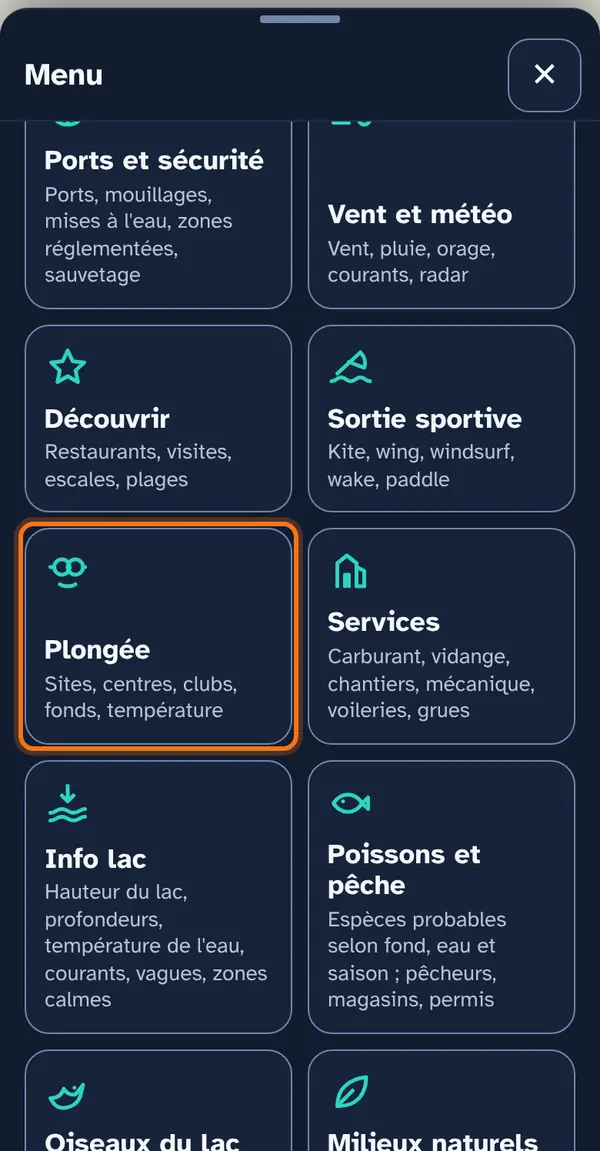
A list, in the order you'd prepare: dive sites; the bottom, in two layers computed in the app (slope, depth bands); launching ramps; then centres and shops, clubs and restricted areas. Below the list, a water temperature profile at depth.
How to use it
Open the menu
Tap Menu, bottom right, then the menu's tile. At the top: 📖 User guide for this menu (this page) and ↺ Reset maps, which switches everything off at once.
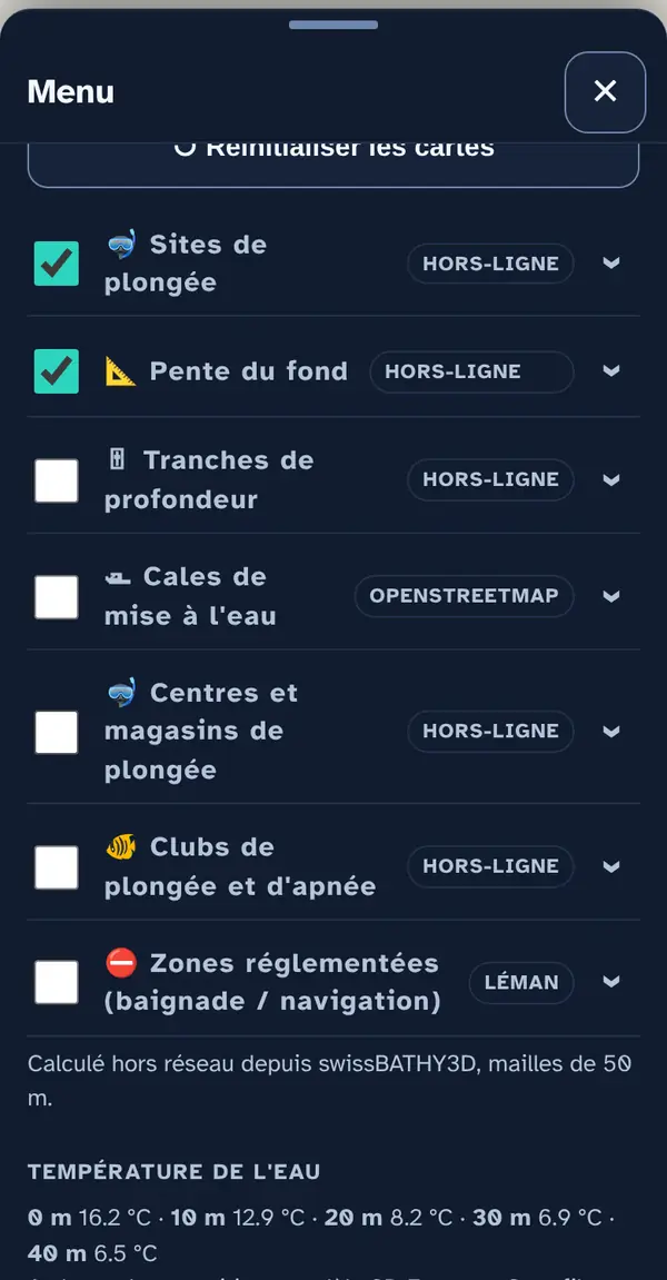
Below the list: Water temperature — “Refresh profile” gives the temperature from the surface to the bottom, offshore from your position, based on the Eawag model.
Turn on a map layer
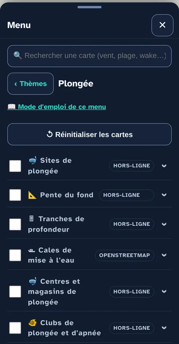
Tick a map layer's box to lay it over the base map; untick it to remove it. The arrow at the right of the row opens its info note: what the layer shows, its colour key, its source and what it doesn't tell you. An OFFLINE label marks a layer built into the app, which works without signal.
Turn on “Restricted areas” before choosing an entry point.
Why checkboxes? So that only what's useful right now goes on the map: ten layers switched on together become unreadable.
Reading the map
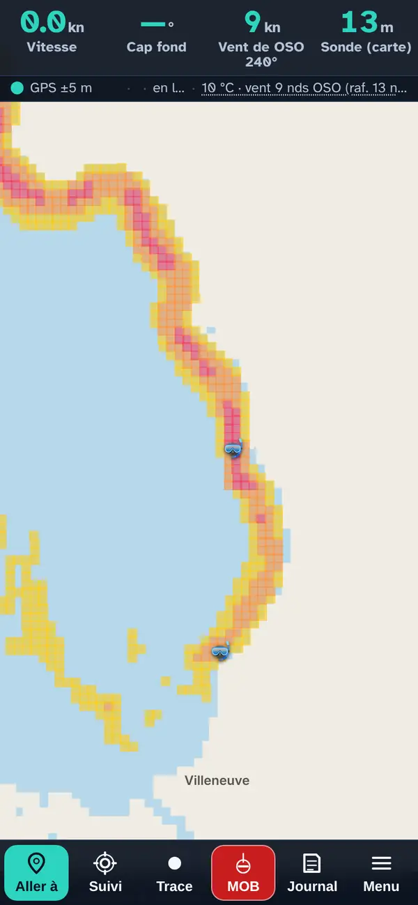
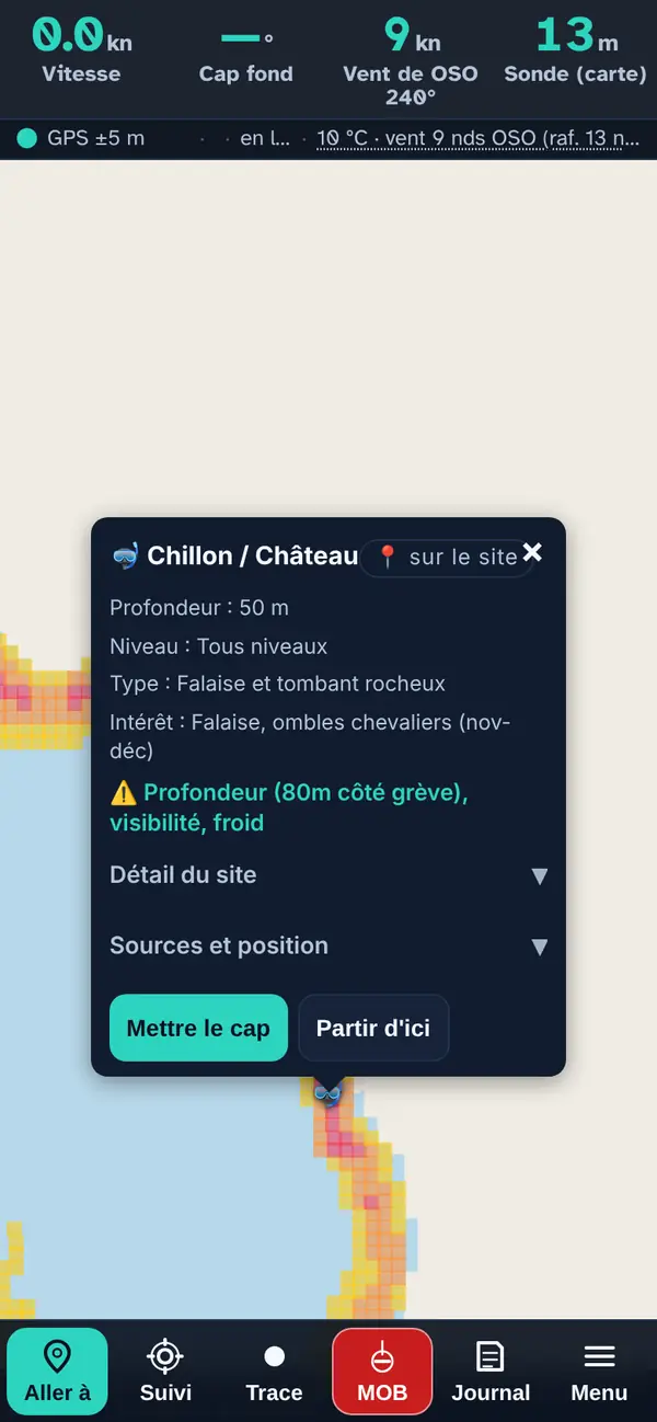
“Dive sites” and “Bottom slope” together, at Chillon: the slope, from yellow (noticeable) to pink (very steep), shows the drop-off along the shore; the icons mark the sites.
Tap a point: the pop-up
- The site name, and “📍 on the site” or “entry point” depending on what the dot marks.
- Stated Depth, Level, bottom Type, Interest (wildlife, wrecks…).
- Hazards (⚠) and site rules: always visible, outside the collapsible section.
- Site details (collapsible): the water entry and the underwater route.
- Sources and position, then Set course / Start from here.
The dot usually marks the entry point: the stated depth is reached further out, and the pop-up tells you which way.
How the data is cross-checked
“Bottom slope” and “Depth bands” are computed in the app, offline, from swisstopo's swissBATHY3D grid (50 m cells): the slope between a cell and its neighbours, and the cell's mean depth. The temperature profile comes from Eawag's 3D model. Sites, centres and clubs come from the app's files.
What this menu tells you, and what it doesn't
What it tells you. Listed sites, the modelled bottom relief, the temperature modelled by Eawag.
What it doesn't tell you. Nothing here replaces proper dive planning: no deco stops, no air supply, no conditions on the day. The app doesn't say whether a site is authorised or an entry point permitted; a local club knows more than any map.
Navleman is a navigation aid, not an official nautical document: the official chart, the storm warning lights and the authorities' instructions always take precedence.