The “Racing” menu: set up a course, start and race, step by step
User guide · updated 19.10.2026
A race dashboard on your phone: the line, the marks, the countdown, then during the race the next mark, the course to steer and when to tack. This guide follows a sample race off Rolle, screen by screen.
What it's for
Racing mode takes you through a race from start to finish, in four stages:
- Prepare — the start line, the marks to round, the wind.
- The countdown — 5 or 3 minutes, synced to the committee's signal.
- The race — the next mark, the course to steer, when to tack, rounding the marks.
- The finish — race time and each lap time, recorded in the logbook.
At each stage, the app shows only the buttons you need. A banner, sitting above the buttons at the bottom of the screen, shows the current figures: during the race you navigate on the map without opening the panel.
Opening the panel
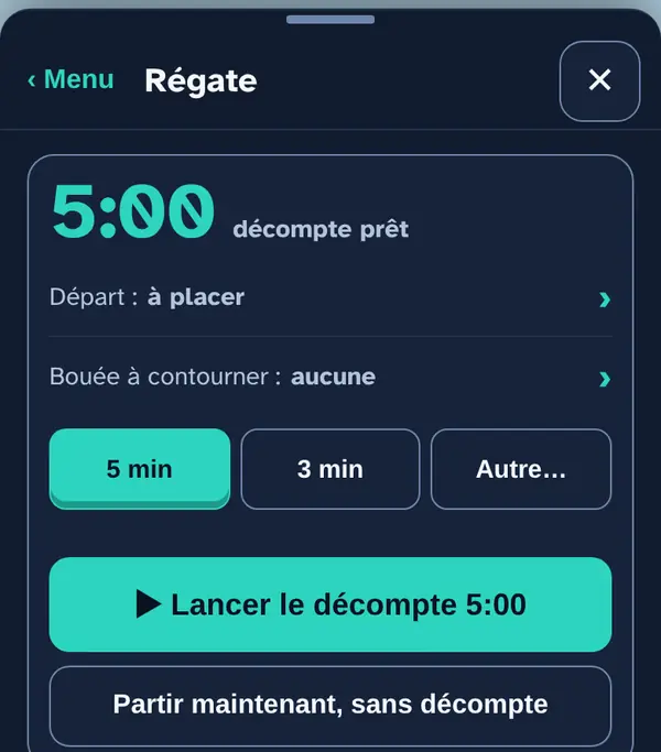
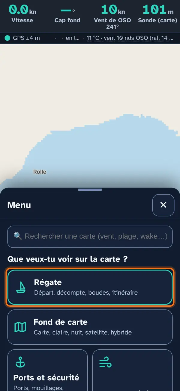
Tap Menu, then the large Racing tile at the top. At the top of the panel: the large clock, then the list of what is ready and what is missing. Tap a line in this list (“Start: to be placed”): it opens the right section directly.
Why this list? Before a start, time is short: it shows at a glance what is left to do, without going through the whole panel.
Setting the start line
The flag mast and the pin end
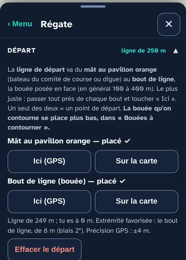
The start line runs from the orange-flag mast (the race committee boat, or a breakwater) to the pin end, the buoy laid opposite, usually 100 to 400 m away.
- Most accurate: sail right past each end and tap Here (GPS) on its row.
- Otherwise, On the map places the end with a crosshair (see the mark, below).
- With only one of the two ends placed, you get a simple start point.
Below the buttons: the line length, your distance, the favoured end (the one furthest upwind, with the difference in metres) and the GPS accuracy.
Why pass right by the ends? On a 250 m line, a few metres of error change the favoured end and the distance to the line at the start.
Placing the marks to round
With the crosshair
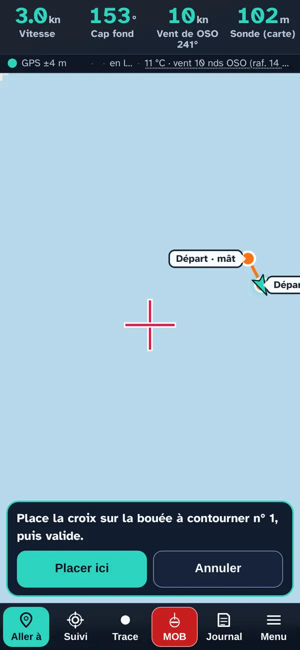
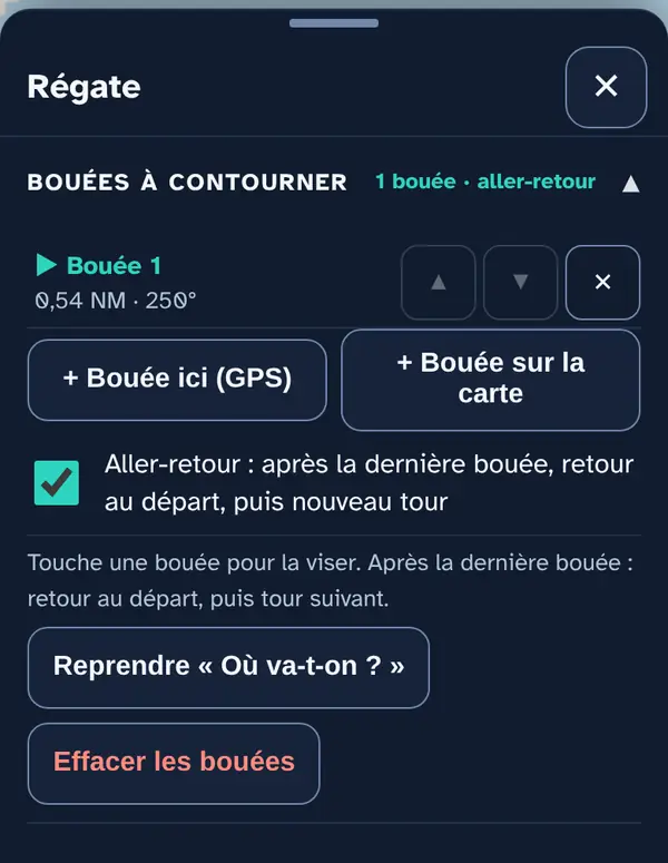
In Marks to round, tap + Mark on map: a crosshair appears in the centre. Drag the map until the crosshair is on the mark, then Place here. If you are next to the mark, + Mark here (GPS) is more accurate.
The course
Place the marks in course order; the ▲ ▼ arrows change the order, ✕ deletes one. With Round trip, after the last mark you return to the line, which closes the lap, and set off on another lap, as many times as the race requires.
Use “Where to?” turns the destination of your route into the only mark: handy for a point-to-point race.
The wind
Where the wind value comes from
Three sources to choose from:
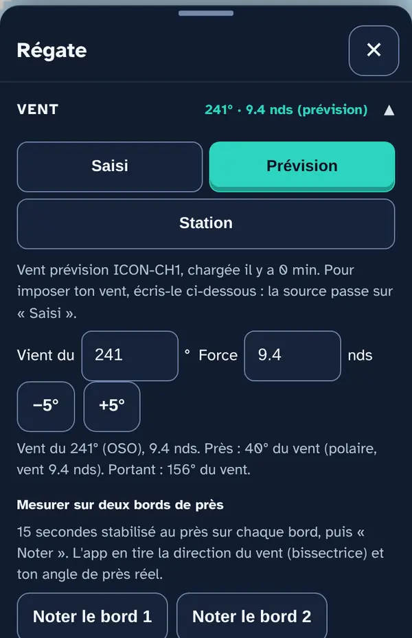
- Forecast (default): MeteoSwiss's ICON-CH1 model, at your position.
- Station: the wind measured by the nearest station, less than 15 km away and read less than an hour ago.
- Manual: your own direction and strength. −5° / +5° follow a shift with one tap; they are logged under “Logged shifts”.
Measure over two close-hauled tacks: settle close-hauled on one tack for 15 seconds, tap Record tack 1, tack, then repeat with tack 2. The app works out the wind direction (the bisector of the two courses) and your true pointing angle.
Why does the wind matter so much? The favoured end, the laylines and the route depend on it. Without a known wind, the app doesn't show them rather than guess.
The route to the marks
The calculation
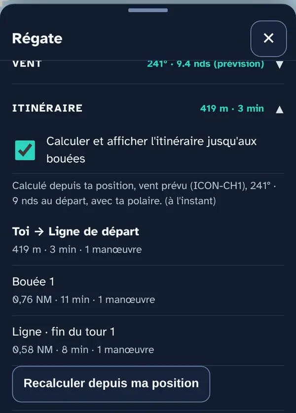
As soon as a mark exists, the app calculates the fastest route using your boat's polar: from your position to the line, then from mark to mark. Each leg shows its distance, duration and number of manoeuvres. It is recalculated when you round a mark, when the wind changes, when a new forecast comes in or when you stray from the route.
On the map
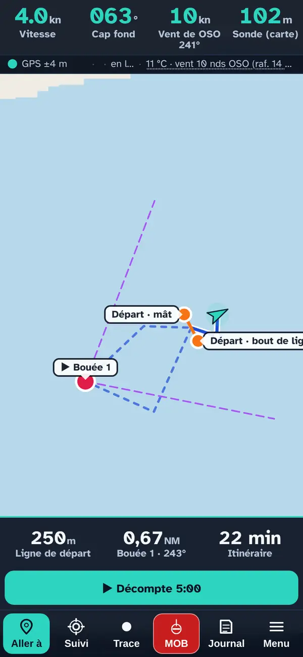
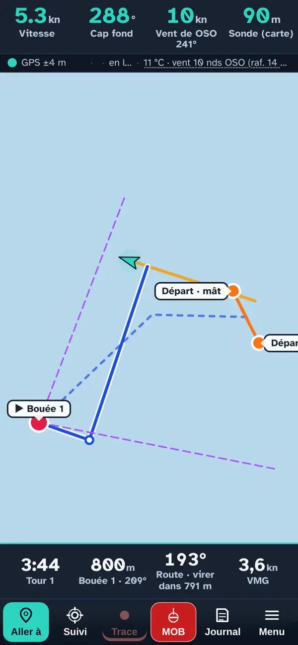
- Orange: the start line.
- Red: the buoys; ▶ marks the one you are heading for.
- Blue dashes: the calculated route.
- Purple dashes: the laylines, the upwind (or downwind) courses that take you straight to the buoy without tacking again.
The bottom banner shows the line length, the distance to the buoy and the route time, and starts the countdown with one tap.
Saving your courses
My courses
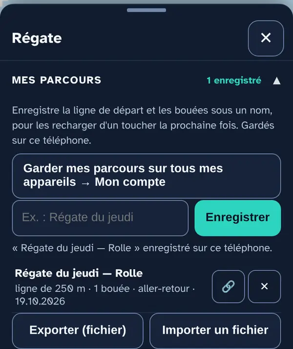
Enter a name (“Thursday race”) and tap Save: the line and buoys are kept on this phone. Tap the name to reload the course the following week. 🔗 creates a link to send to your crew; Export (file) and Import a file work through a file. With an account (My account), your courses follow you to your other devices.
The countdown
Starting
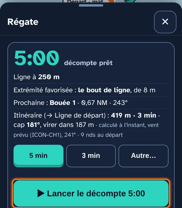
Choose 5 min, 3 min or Other… (a number of minutes, or the exact start time), then tap ▶ Start countdown on the committee's signal. The app sounds at the signals: for 5 minutes, at 5, 4 and 1 minute to go, then at the start. It keeps the screen on.
Start now, no countdown (two taps) starts the race straight away: handy for training.
Syncing with the committee
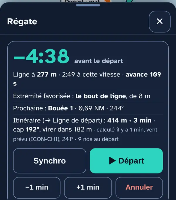
- Sync: tap it on the committee's next signal. The countdown snaps to the nearest whole minute (not in the last 30 seconds).
- −1 min / +1 min: if the committee delays or brings forward the sequence.
- Cancel (two taps): stops the countdown; the course stays.
Why Sync? You rarely start the countdown to the exact second. One tap on the next signal is enough to put the clock right.
Approaching the line
The start banner
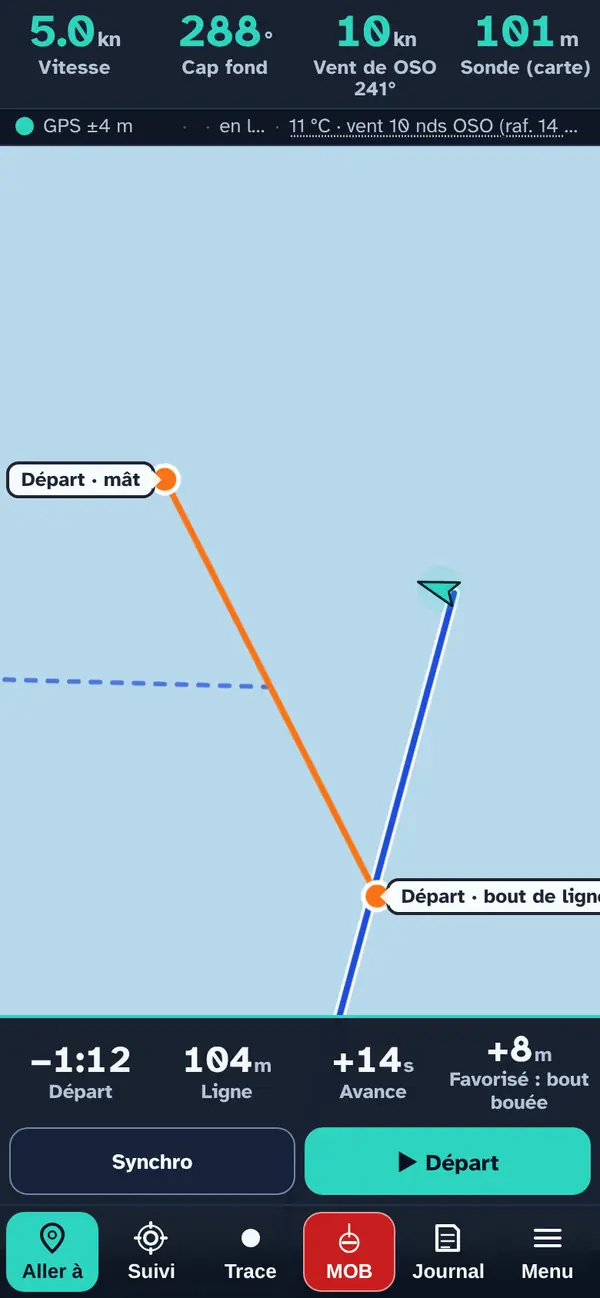
During the countdown, the banner shows:
- the time to the start;
- the distance to the line — in red with “course side” if you are on the wrong side;
- your time ahead (or behind): at your current speed, how many seconds before the signal you would reach the line. “+14 s”: slow down or extend a little;
- the favoured end and its gain in metres.
▶ Start (two taps) starts the race manually, if the signal comes before the end of the countdown.
During the race
The race banner
At the signal, the track starts recording and the banner switches to race mode:
- the race timer and the lap number;
- the target buoy: distance and bearing;
- the course: the course to steer, and “tack in 354 m” (or “gybe”) for the next manoeuvre on the route;
- the VMG: your velocity made good towards the wind (upwind) or away from it (downwind); on other points of sail, the VMC, your speed towards the buoy.
On the map, your track in orange, the route in blue and the laylines in purple.
Rounding the marks
Automatic, and can be undone
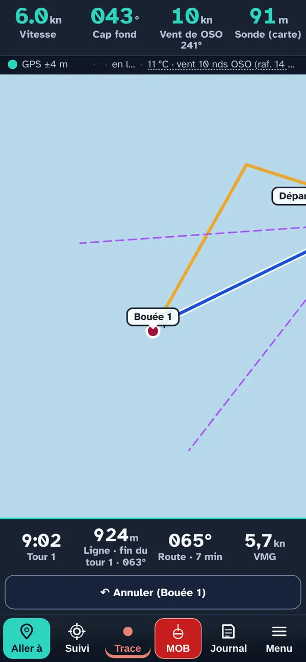
A buoy is rounded automatically when you enter its radius (30 m by default) and then move away, or when you have rounded it a little further out. The app then targets the next one — here the line, to finish the lap.
- ↶ Undo, in the banner for 20 seconds, if the rounding was a mistake; after that, ↶ Previous mark, in the panel.
- ✓ Mark rounded forces the rounding manually.
- The radius and automatic rounding are set in Settings.
Why “when moving away”? You only pass a buoy once you have rounded it: the app waits for you to move off so it doesn't switch target too early.
The finish
Finishing the race
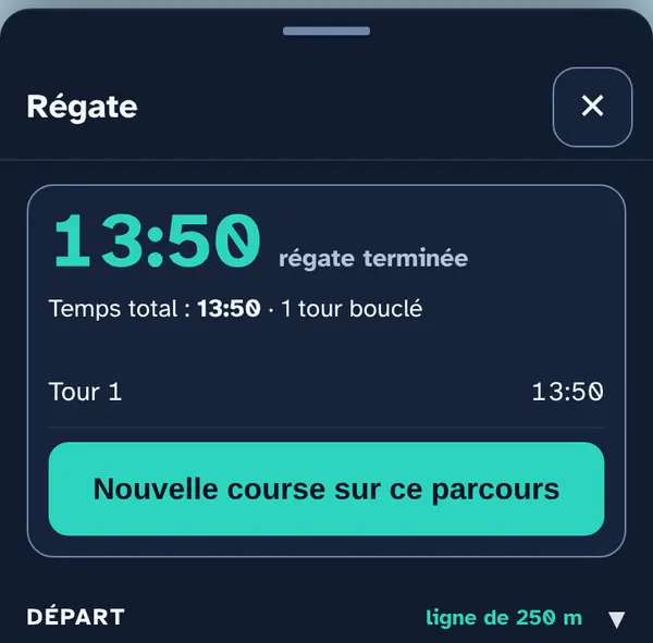
On an out-and-back course, the start line is also the finish line on every lap: crossing it closes the lap. The race only stops when you tap 🏁 Finish (two taps): if tapped within 3 minutes of crossing the line, it stops the clock at the moment you crossed, not when you finally got your phone out.
- New race on this course: same line, same buoys, new countdown.
- ↺ General recall (two taps): cancels the start and goes back to the countdown.
- Leave the race: removes the banner and the lines; the course is kept for next time.
The start, each buoy, each lap and the finish are recorded in the logbook.
Frequently asked questions
Does the app tell me if I started too early?
It shows “course side” when the GPS places you beyond the line during the countdown. But only the race committee rules on a premature start; the app does not settle any racing rules question.
Why are the VMG and tack slow to update after tacking?
The GPS gives the course over ground, not the boat's heading: it needs a few seconds on the new course to catch up. Current and drift also shift the course over ground slightly.
What if the phone goes to sleep or the app closes?
The app keeps the screen on during the countdown and the race. If it is closed anyway, it resumes when reopened: the countdown carries on, and if the signal has passed in the meantime, the start is recorded in the logbook.
No signal?
The line, buoys, countdown, race timer and buoy rounding work with GPS alone. The forecast and the weather station need a connection: load them in the harbour, or enter the wind manually.
What this menu tells you, and what it doesn't
What it tells you. The time, the distance to the line, the course and the next manoeuvre, buoy rounding, the fastest route based on your polar and the selected wind.
What it doesn't tell you. The GPS gives the course over ground, not the heading: VMG, tack and layline lag a few seconds behind after tacking, and the current shifts them. The displayed accuracy (± m) also applies to the distance to the line: below it, the app doesn't know which side you are on. Only the race committee rules on a premature start; the app does not settle any racing rules question.
Navleman is a navigation aid, not an official nautical document: the official chart, the storm warning lights and the authorities' instructions always take precedence.